
Drafted — not technically validated
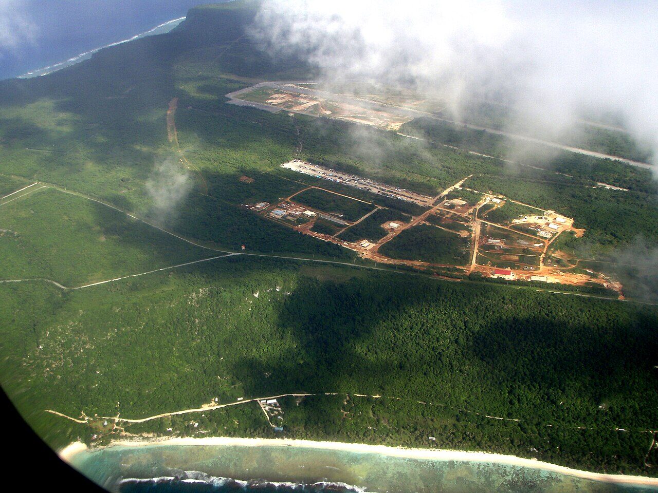
Record revision 1 · Guam's bomber base: B-29s against Japan, B-52s over Vietnam and today the forward base for the heavy bombers in the Western Pacific.
A real-world airfield as described in public sources, and how sim maps represent it. Units, facilities and names change; each is dated where the sources allow, and the charts are not for navigation. Use current official publications for flight planning.
Location and identity
- Country or territory
- Guam (US territory)
- Coordinates
- 13.5840° N, 144.9300° E [7]
- Elevation
- 617 ft (188 m) [2]
- Identifiers
- ICAO PGUA · IATA UAM · FAA UAM
- Other names
- North Field (former name, from 1944, end not given) [1]
- Opened
- 3 December 1944, as North Field [1]
- Theatre
- East Asia and the Pacific
Role and operators
- Status
- Active · Military
- Roles today
- Bomber · Forward staging and deployments
Units
Permanently based units belong to the airfield; rotational and temporarily deployed units are there for a period or an operation. Dates are when the sources place each unit there; "as of" is when a source described it as current.
Current
36th Wing, the host wing, which flies no aircraft of its own and supports deployed Air Force and visiting foreign units [1]
- Service
- United States, air force
- Basing
- Permanently based
- When
- as of Oct 2026
Bomber task force deployments, as needed [1]
- Service
- United States, air force
- Basing
- Temporarily deployed
- Aircraft
- B-1B, B-2, B-52
- When
- since Apr 2020
Earlier
Continuous bomber presence: bomber squadrons taking turns on Guam [1]
- Service
- United States, air force
- Basing
- Rotational
- Aircraft
- B-1B, B-2, B-52
- When
- 2004 – Apr 2020
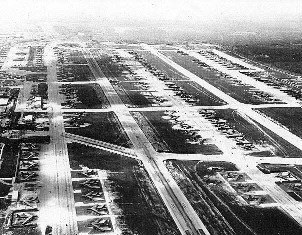
B-52 force for Operation Linebacker II, with U-Tapao in Thailand: more than 150 aircraft [1]
- Service
- United States, air force
- Basing
- Temporarily deployed
- Aircraft
- B-52
- When
- Dec 1972
314th Bombardment Wing [1]
- Service
- United States, air force
- Basing
- Permanently based
- Aircraft
- B-29
- When
- as of 1945
Runways and facilities
From data effective Oct 2026. Facilities not listed here are not documented in the sources cited, which does not mean the airfield lacks them.
| Runway | Length | Width | Surface |
|---|---|---|---|
| 06L/24R [2] | 10,528 ft (3,209 m) | 200 ft (61 m) | asphalt and concrete |
| 06R/24L [2] | 11,200 ft (3,414 m) | 200 ft (61 m) | asphalt and concrete |
- Arresting gear
- Navaids
- Other
- Northwest Field, a historic airfield beside the base, now used for training [1]
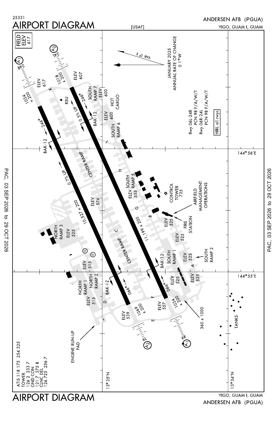
Figure 1 — Airfield map of Andersen Air Force Base (to scale)
- Runway
- Taxiway, with its name
- Apron
- Hangar or terminal
Runways, taxiways, aprons and buildings mapped at the airfield, which OpenStreetMap gives no boundary, true north up, drawn from OpenStreetMap data retrieved 2026-11-01. Widths come from the map data or, where it gives none, a typical 45 m runway and 18 m taxiway. Map data © OpenStreetMap contributors, available under the ODbL 1.0. Community-mapped, not an official aerodrome chart, and not for navigation.
Sim maps
Represented in: DCS: Marianas
DCS: Marianas DCS World · Present day
Represented as “Andersen AFB” · checked 2026-10-27 [4] [5]
- The map's main airbase [4]
- Runways 06L/24R and 06R/24L [5]
- Tower 126.2 MHz VHF and 250.1 MHz UHF [5]; the FAA lists the tower on 126.2 MHz [2]
Differences from the real airfield
DCS: Marianas 1944 DCS World · Second World War
Not yet checked
The map shows Guam under Japanese control in the summer of 1944 [6], before North Field was built. [1]
Only the maps marked represented or confirmed absent have been checked. Any other map may or may not represent this airfield.
Other maps in East Asia and the Pacific, not yet checked for this airfield, which may lie outside them: Falcon BMS: Korea, Falcon 4.0: Korea.
Role today
Andersen is the most important US air base west of Hawaii. [1] It is one of the Air Force’s four forward operating locations for bombers and the only base in the Western Pacific that can permanently support the heavy bombers, the B-1B, B-2 and B-52. [1] Guam’s almost unrestricted airspace and the bombing range on Farallon de Medinilla, an island 184 miles north, make it a good place to train. [1] Its host, the 36th Wing, flies no aircraft of its own; it supports the Air Force and foreign units that deploy there. [1]
History
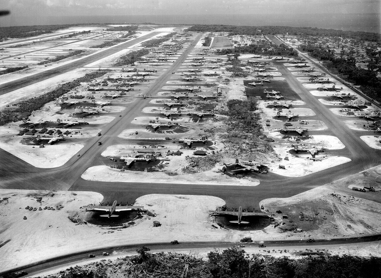
The base began as North Field, the first airfield built on Guam after its liberation in 1944. [1] With Northwest Field it had four main runways and revetments for more than 200 B-29s, and from early 1945 the 314th Bombardment Wing flew its raids on Japan from here. [1] It was named for Brigadier General James Roy Andersen, lost in the crash of a B-24 between Kwajalein and Johnston Island in February 1945. [1]
In the Vietnam War Andersen launched the B-52 raids of Operation Arc Light from 1965, and in the eleven days of Linebacker II in December 1972 more than 150 B-52s flew 729 sorties against North Vietnam from Andersen and U-Tapao in Thailand. [1] The 54th Weather Reconnaissance Squadron flew WC-130s from Andersen into typhoons from the 1960s to 1987. [1] From 2004 to April 2020, B-1Bs, B-2s and B-52s took turns to keep a continuous bomber presence on Guam; bombers still deploy there as needed. [1]


Sources
- Andersen Air Force Base. Wikipedia (secondary source). https://en.wikipedia.org/wiki/Andersen_Air_Force_Base (accessed 2026-10-27).
- Airport data: UAM (PGUA), Andersen AFB. Federal Aviation Administration, Aeronautical Information Services, data effective 1–29 October 2026. https://nfdc.faa.gov/nfdcApps/services/ajv5/airportDisplay.jsp?airportId=UAM (accessed 2026-10-27).
- Airport Diagram, Andersen AFB (PGUA). Federal Aviation Administration, digital Terminal Procedures Publication, Pacific, 3 September–29 October 2026. https://aeronav.faa.gov/d-tpp/2610/02147AD.PDF (accessed 2026-10-27).
- DCS: Marianas Map. Eagle Dynamics (product page). https://www.digitalcombatsimulator.com/en/shop/terrains/marianas_terrain/ (accessed 2026-10-27).
- pydcs terrain data: Mariana Islands airports (airports.py). pydcs, an open-source Python library for building DCS World missions. https://github.com/pydcs/dcs/blob/5ddcc63a2dcd661e16b14f7aa43219b93044855d/dcs/terrain/marianaislands/airports.py (accessed 2026-10-27). Andersen AFB entry: ATC radios, and runways 06L/24R and 06R/24L, each approach with an empty list of runway beacons.
- DCS: Marianas WWII Map. Eagle Dynamics (product page). https://www.digitalcombatsimulator.com/en/shop/terrains/marianas_wwii_terrain/ (accessed 2026-10-27).
- Airport data, PGUA. OurAirports open data (public domain, community-maintained). https://davidmegginson.github.io/ourairports-data/airports.csv (accessed 2026-10-28). Row for PGUA: latitude, longitude and identifiers.
Wikipedia articles are secondary sources and can change; they are cited with the date they were read. FAA airport data and diagrams are official but are reissued every 28 or 56 days; each is cited with the edition read. pydcs mirrors the DCS terrain data at the commit linked.