
Drafted — not technically validated
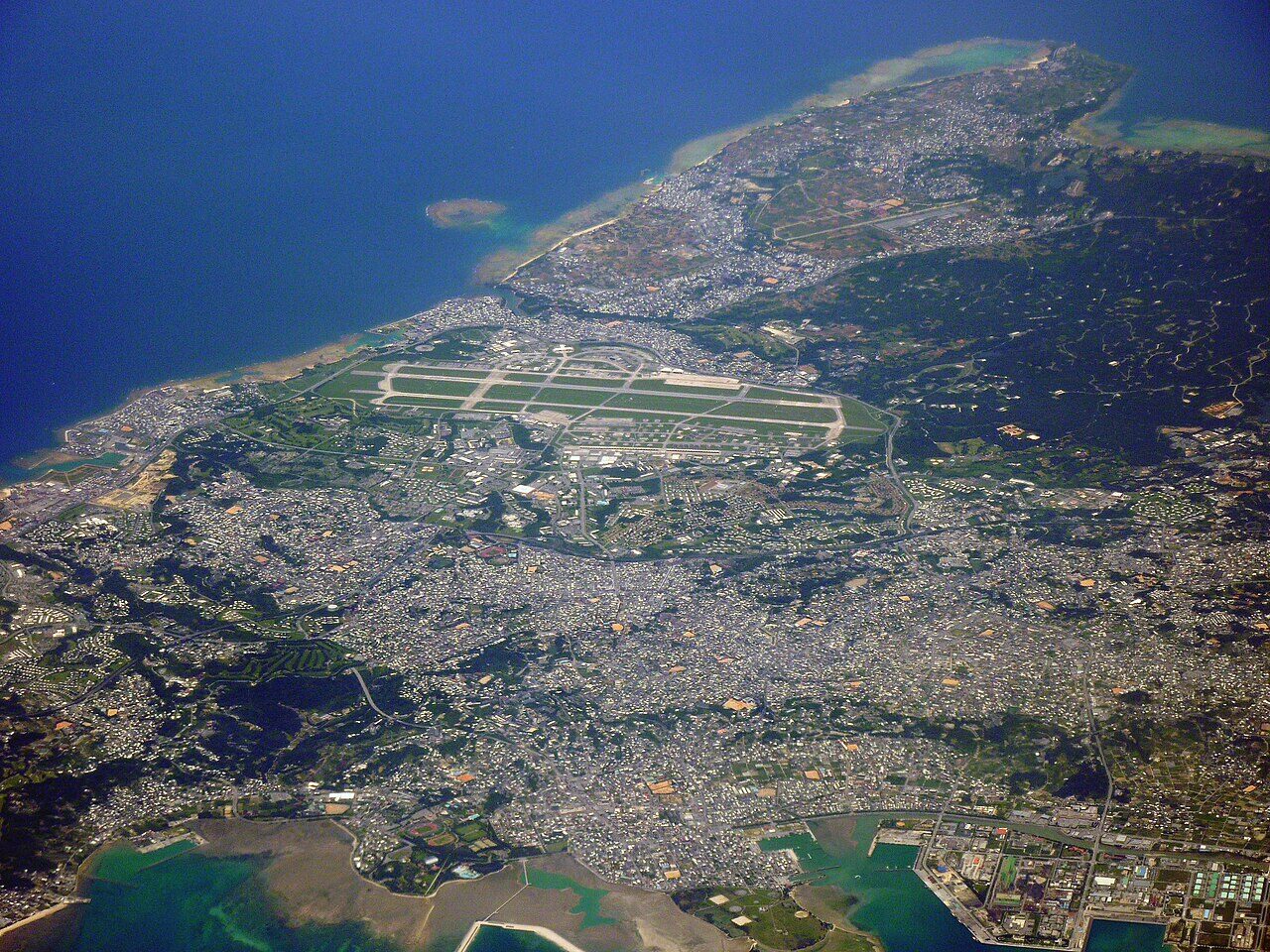
Record revision 1 · The Keystone of the Pacific on Okinawa: the largest US Air Force base in East Asia and home of the 18th Wing.
A real-world airfield as described in public sources, and how sim maps represent it. Units, facilities and names change; each is dated where the sources allow, and the charts are not for navigation. Use current official publications for flight planning.
Location and identity
- Location
- Okinawa, Japan [1]
- Country or territory
- Japan
- Coordinates
- 26.3517° N, 127.7694° E [4]
- Elevation
- 143 ft (44 m) [1]
- Identifiers
- ICAO RODN · IATA DNA
- Other names
- Yara Hikojo (former name, until Apr 1945) [1]
- Opened
- 1945: built as Yara Hikojo for the Imperial Japanese Army Air Force and captured by US forces in the Battle of Okinawa, April 1945 [1]
- Theatre
- East Asia and the Pacific
Role and operators
- Status
- Active · Military
- Roles today
- Airlift and tanker · Reconnaissance and surveillance · Search and rescue · Special operations
Units
Permanently based units belong to the airfield; rotational and temporarily deployed units are there for a period or an operation. Dates are when the sources place each unit there; "as of" is when a source described it as current.
Current
18th Wing, the host wing and the Air Force's largest combat wing, with the 909th Air Refueling Squadron, the 961st Airborne Air Control Squadron and the 33rd Rescue Squadron [1]
- Service
- United States, air force
- Basing
- Permanently based
- Aircraft
- KC-135R, E-3 Sentry, HH-60G
- When
- as of Oct 2026
353rd Special Operations Wing [1]
- Service
- United States, air force
- Basing
- Permanently based
- When
- as of Oct 2026
1st Battalion, 1st Air Defense Artillery Regiment [1]
- Service
- United States, army
- Basing
- Permanently based
- When
- as of Oct 2026
Earlier
Runways and facilities
The sources do not date these figures. Facilities not listed here are not documented in the sources cited, which does not mean the airfield lacks them.
| Runway | Length | Width | Surface |
|---|---|---|---|
| 05R/23L [1] [2] | 12,100 ft (3,688 m) | 200 ft (61 m) | asphalt and concrete |
| 05L/23R [1] [2] | 12,100 ft (3,688 m) | 300 ft (91 m) | asphalt and concrete |
- Arresting gear
- None documented in the sources cited
- Navaids
- None documented in the sources cited
Figure 1 — Runways at Kadena Air Base (plan view, to scale)
Runways drawn to scale between their published threshold coordinates, true north up. Taxiways, aprons and buildings are not drawn. Threshold coordinates and widths from OurAirports [2]; lengths from the Japanese AIP as given in [1]. Not for navigation.
Sim maps
Represented in: no map checked so far
Falcon BMS: Korea Falcon BMS · Present day
Not yet checked
Falcon BMS's Korea theatre has an airbase charted as Fukuoka / Kadena on the Japanese main islands, not on Okinawa. The person who maintained Falcon's airbase data says MicroProse named it Kadena in the original Falcon 4.0, which was geographically wrong, and it was renamed as the best geographically correct compromise. [3]
No sim map has been checked against this airfield yet. That is not a claim that no map represents it.
Other maps in East Asia and the Pacific, not yet checked for this airfield, which may lie outside them: DCS: Marianas, DCS: Marianas 1944, Falcon 4.0: Korea.
Role today
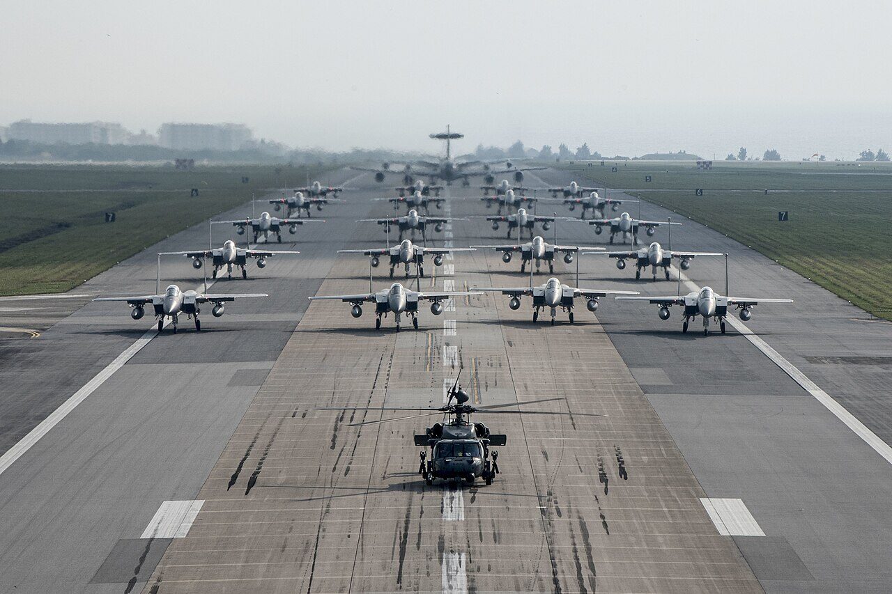
Kadena is the largest and busiest US Air Force base in East Asia, and is often called the “Keystone of the Pacific” for where it sits: about 650 km from the coast of China. [1] More than 20,000 Americans and Japanese employees live or work on it. [1] Its host, the 18th Wing, is the Air Force’s largest combat wing, and flies tankers, airborne warning aircraft and rescue helicopters. [1] The 48 F-15C Eagles once stationed there permanently have gone, and Nikkei Asia reported in late 2023 that the Air Force would base F-15EX Eagle IIs there instead. [1]
History
The field was a small strip, Yara Hikojo, finished for the Imperial Japanese Army Air Force just before the Battle of Okinawa, and was one of the first objectives of the US 7th Infantry Division. [1] What the Americans captured was 4,600 ft of badly damaged coral runway; by nightfall on 4 April it could take emergency landings, and by August engineers had built a 6,500 ft and a 7,500 ft runway for fighters and bombers. [1] Eighth Air Force moved its headquarters nearby in July 1945 to prepare B-29 groups for the invasion of Japan, which the surrender made unnecessary. [1]
From Kadena, B-29s flew over Korea from 1950, and B-52s flew Arc Light missions over Southeast Asia from 1965 to 1970. [1] The SR-71s of Detachment OL-8 flew from Kadena from 1968 until 1990, earning the nickname “Habu” after an Okinawan pit viper. [1] The F-15 Eagle arrived in 1979, and in 1991 the 18th Wing took on tankers, E-3 Sentries and, from 1993, rescue for the Western Pacific and Indian Ocean. [1]

Sources
- Kadena Air Base. Wikipedia (secondary source). https://en.wikipedia.org/wiki/Kadena_Air_Base (accessed 2026-10-27). Its runway lengths and elevation cite the Japanese AIP, AD 2 RODN, which could not be reached from here.
- Runway data, RODN Kadena Air Base. OurAirports open data (public domain, community-maintained). https://davidmegginson.github.io/ourairports-data/runways.csv (accessed 2026-10-27). Rows for RODN: threshold latitude and longitude, length and width of each runway.
- Chart error in Japan airfield. Falcon BMS forum (community discussion). https://forum.falcon-bms.com/topic/17513/chart-error-in-japan-airfield/1 (accessed 2026-10-27). Reply by Red Dog, who maintained Falcon's airbase and navigation data, on why the BMS chart shows Fukuoka / Kadena on mainland Japan.
- Airport data, RODN. OurAirports open data (public domain, community-maintained). https://davidmegginson.github.io/ourairports-data/airports.csv (accessed 2026-10-28). Row for RODN: latitude, longitude and identifiers.
Wikipedia articles are secondary sources and can change; they are cited with the date they were read. FAA airport data and diagrams are official but are reissued every 28 or 56 days; each is cited with the edition read. pydcs mirrors the DCS terrain data at the commit linked.