
Drafted — not technically validated
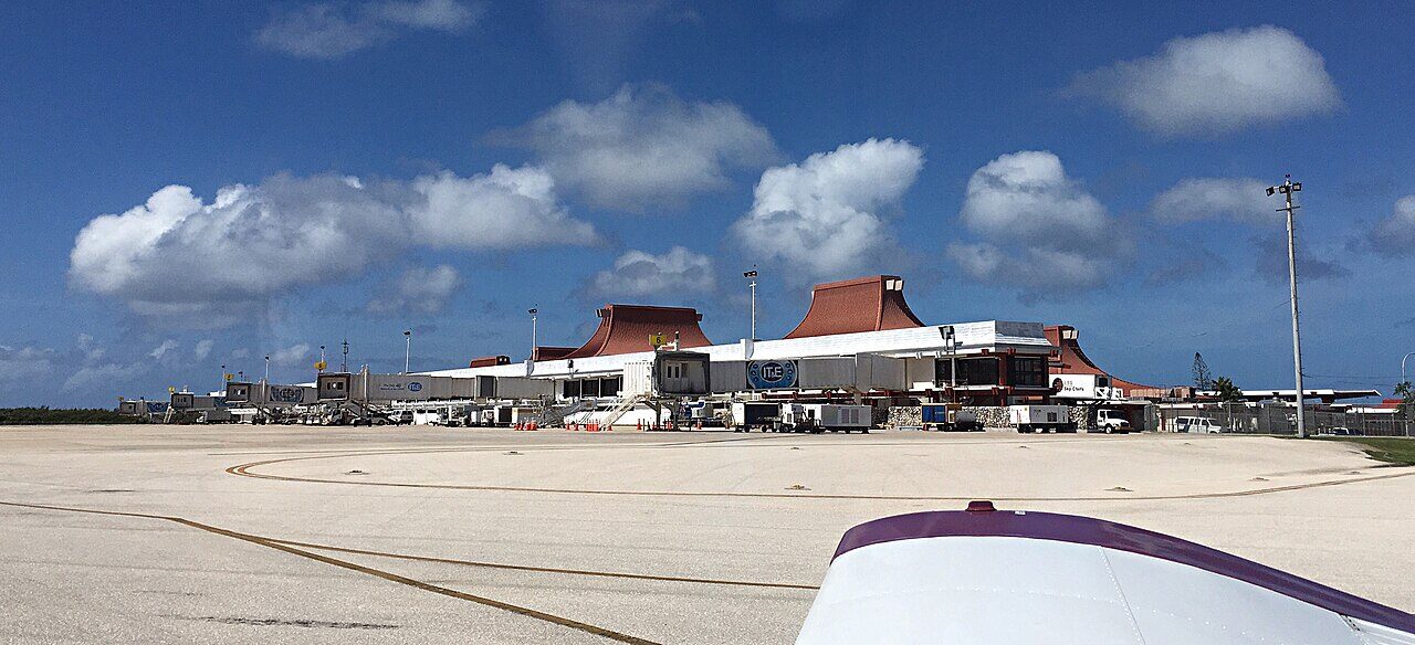
Record revision 1 · The Japanese Aslito Field captured in June 1944 and rebuilt as Isely Field for B-29s against Japan, now the Northern Mariana Islands' civil airport.
A real-world airfield as described in public sources, and how sim maps represent it. Units, facilities and names change; each is dated where the sources allow, and the charts are not for navigation. Use current official publications for flight planning.
Location and identity
- Location
- Southern Saipan, Northern Mariana Islands, 4 miles south-west of the island's main town [2]
- Country or territory
- Northern Mariana Islands (US commonwealth)
- Coordinates
- 15.1194° N, 145.7288° E [6]
- Elevation
- 214 ft (65 m) [2]
- Identifiers
- ICAO PGSN · IATA SPN · FAA GSN
- Other names
- Opened
- 1933, as a temporary landing field built by the Imperial Japanese Navy Air Service on a sugarcane field [1]
- Theatre
- East Asia and the Pacific
Role and operators
- Status
- Active · Civil
- Roles today
- Civil airport
- Operators
- Commonwealth Ports Authority, owner of the public airport · Northern Mariana Islands (US commonwealth), civil · current; start date not given [1] [2]
- Imperial Japanese Navy Air Service · Japan, navy · 1933 – 18 Jun 1944 [1]
- US Navy and US Army Air Forces, Naval Advance Base Saipan, and Twentieth Air Force B-29 operations · United States, joint or defence-wide · 18 Jun 1944 – Dec 1945 [1]
Units
Permanently based units belong to the airfield; rotational and temporarily deployed units are there for a period or an operation. Dates are when the sources place each unit there; "as of" is when a source described it as current.
Earlier
73rd Bombardment Wing: the 497th, 498th, 499th and 500th Bombardment Groups, under XXI Bomber Command [1]
- Service
- United States, air force
- Basing
- Permanently based
- Aircraft
- B-29 Superfortress
- When
- 12 Oct 1944 – Dec 1945
19th Fighter Squadron, the first US aircraft to arrive [1]
- Service
- United States, air force
- Basing
- Not stated in the sources
- Aircraft
- P-47
- When
- as of Jun 1944
Runways and facilities
From data effective Oct 2026. Facilities not listed here are not documented in the sources cited, which does not mean the airfield lacks them.
| Runway | Length | Width | Surface |
|---|---|---|---|
| 07/25 [2] | 8,699 ft (2,651 m) | 200 ft (61 m) | grooved asphalt |
| 06/24 [2] | 7,001 ft (2,134 m) | 100 ft (30 m) | asphalt |
- Arresting gear
- None documented in the sources cited
- Navaids
- ILS/DME runway 07 (I-GSN, 109.9 MHz, channel 36X) [2]
Sim maps
Represented in: DCS: Marianas, DCS: Marianas 1944
DCS: Marianas DCS World · Present day
Represented as “Saipan Intl” · checked 2026-10-27 [3] [5]
- One of the large airfields on the map's main islands [3]
- Tower 125.7 MHz VHF and 256.9 MHz UHF [5], the frequencies the FAA lists for Saipan Tower [2]
Differences from the real airfield
DCS: Marianas 1944 DCS World · Second World War
Represented as “Isley” · checked 2026-10-28 [4] [7]
- Named Isley in the game's own airfield data, although the product page calls the map's Saipan airfield Aslito [4] [7]
- Shown as a Japanese airfield in early 1944, with wooden revetments, sandbagged searchlights and minimal radio aids; navigation is by compass and coastal landmarks [4]
- The map's period, 15 June to 10 August 1944, spans the field's capture on 18 June and its first weeks as Isely Field [1] [4]
Only the maps marked represented or confirmed absent have been checked. Any other map may or may not represent this airfield.
Other maps in East Asia and the Pacific, not yet checked for this airfield, which may lie outside them: Falcon BMS: Korea, Falcon 4.0: Korea.
Role today
Saipan International Airport is the public airport of the Northern Mariana Islands, owned by the Commonwealth Ports Authority. [1] [2] Most of its traffic is air taxi and general aviation, including the short hops to Tinian and Rota; military flights are under 1% of its operations. [1] For a mission set in the present it is a civil field with a tower, an ILS and two runways. [2]
History
The Imperial Japanese Navy Air Service laid out a landing field on a sugarcane field here in 1933 and from 1937 built it up for full military use, although the League of Nations mandate under which Japan held the islands banned military works. [1] After the attack on the United States in 1941 it was named Aslito Field, from the Chamorro name of the area. [1]
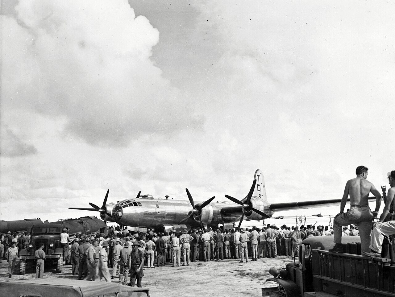
The US Army’s 27th Infantry Division captured the airfield on 18 June 1944, during the Battle of Saipan. [1] It was renamed Isely Field for Commander Robert H. Isely, a US Navy pilot killed strafing it on 13 June, and Seabees repaired and enlarged it as Naval Advance Base Saipan; P-47sP-47D Thunderbolt AircraftThe heaviest single-engined fighter of the war: eight .50 calibre guns, a turbosupercharged radial, and a fearsome fighter-bomber. of the 19th Fighter SquadronSquadron GlossaryJoint terms: 1. An organization consisting of two or more divisions of ships, or two or more divisions (Navy) or flights of aircraft. 2. The basic administrative aviation unit of the Army, Navy, Marine Corps, and Air Force. 3… were the first US aircraft to arrive. [1] The first B-29 landed on 12 October 1944, and by late November more than 100 were there, flying with the 73rd Bombardment WingWing GlossaryJoint terms: 1. An Air Force unit composed normally of one primary mission group and the necessary supporting organizations. 2. A fleet air wing is the basic organizational and administrative unit for naval-, land-, and tender-based… first in high-altitude daylight raids on Japan’s aircraft industry and then in the low-level night incendiary raids on Tokyo, Nagoya and Osaka. [1] Most Japanese air attacks on the Marianas between November 1944 and January 1945 were aimed at Isely Field. [1]
The 73rd Bombardment Wing left for the United States in December 1945, and the airfield returned to civil use. [1] Its surviving wartime facilities were listed on the National Register of Historic Places in 1981 as the Isely Field Historic District. [1] The airport was renamed for Francisco C. Ada, a former lieutenant governor of the Northern Mariana Islands, in 2005. [1]

Sources
- Saipan International Airport. Wikipedia (secondary source). https://en.wikipedia.org/wiki/Saipan_International_Airport (accessed 2026-10-27).
- Airport data: GSN (PGSN), Francisco C Ada/Saipan Intl. Federal Aviation Administration, Aeronautical Information Services, data effective 1–29 October 2026. https://nfdc.faa.gov/nfdcApps/services/ajv5/airportDisplay.jsp?airportId=GSN (accessed 2026-10-28).
- DCS: Marianas Map. Eagle Dynamics (product page). https://www.digitalcombatsimulator.com/en/shop/terrains/marianas_terrain/ (accessed 2026-10-27).
- DCS: Marianas WWII Map. Eagle Dynamics (product page). https://www.digitalcombatsimulator.com/en/shop/terrains/marianas_wwii_terrain/ (accessed 2026-10-28).
- pydcs terrain data: Mariana Islands airports (airports.py). pydcs, an open-source Python library for building DCS World missions, whose terrain data mirrors the game's. https://github.com/pydcs/dcs/blob/5ddcc63a2dcd661e16b14f7aa43219b93044855d/dcs/terrain/marianaislands/airports.py (accessed 2026-10-27). Saipan Intl entry: ATC radios, and runway 07-25 with an empty list of runway beacons at each end.
- Airport data, PGSN. OurAirports open data (public domain, community-maintained). https://davidmegginson.github.io/ourairports-data/airports.csv (accessed 2026-10-28). Row for PGSN: latitude, longitude and identifiers.
- dcs-world-schema reference data: MarianaIslandsWWII airbases (Isley.json). dcs-world-schema, open-source data extracted by running DCS World 2.9.30.28536. https://github.com/YoloWingPixie/dcs-world-schema/blob/c3091e6c08fb8167e26145d0e33c10e4140c6fe7/dcs-world-reference/latest/airbases/MarianaIslandsWWII/Isley.json (accessed 2026-10-28).
Wikipedia articles are secondary sources and can change; they are cited with the date they were read. FAA airport data and diagrams are official but are reissued every 28 or 56 days; each is cited with the edition read. pydcs mirrors the DCS terrain data at the commit linked.