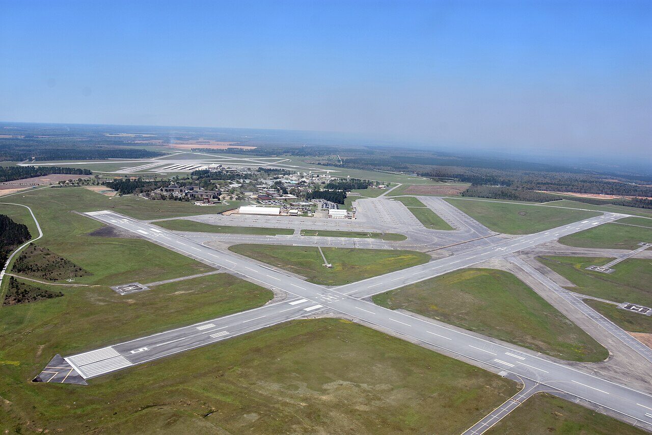

Drafted — not technically validated
Record revision 1 · Two training fields in Florida sharing one base: primary training in the T-6B at North Field and helicopter training at South Field.
A real-world airfield as described in public sources, and how sim maps represent it. Units, facilities and names change; each is dated where the sources allow, and the charts are not for navigation. Use current official publications for flight planning.
Location and identity
- Country or territory
- United States
- Coordinates
- 30.7242° N, 87.0219° W [5]
- Elevation
- 199 ft (61 m) [2]
- Identifiers
- ICAO KNSE · FAA NSE · KNDZ · NDZ
- Other names
- Opened
- 16 July 1943, as Naval Auxiliary Air Station Whiting Field [1]
- Theatre
- North America
Role and operators
- Status
- Active · Military
- Roles today
- Flight training · Helicopter operations
Units
Permanently based units belong to the airfield; rotational and temporarily deployed units are there for a period or an operation. Dates are when the sources place each unit there; "as of" is when a source described it as current.
Current
Training Air Wing Five: primary flight training at North Field and advanced helicopter training at South Field [1]
- Service
- United States, navy
- Basing
- Permanently based
- Aircraft
- T-6B Texan II, TH-73A Thrasher
- When
- as of Oct 2026
Students of the Navy, Marine Corps, Coast Guard and Air Force, and of allied nations [1]
- Service
- United States, joint or defence-wide
- Basing
- Not stated in the sources
- When
- as of Oct 2026
Runways and facilities
From data effective Oct 2026. Facilities not listed here are not documented in the sources cited, which does not mean the airfield lacks them.
| Runway | Length | Width | Surface |
|---|---|---|---|
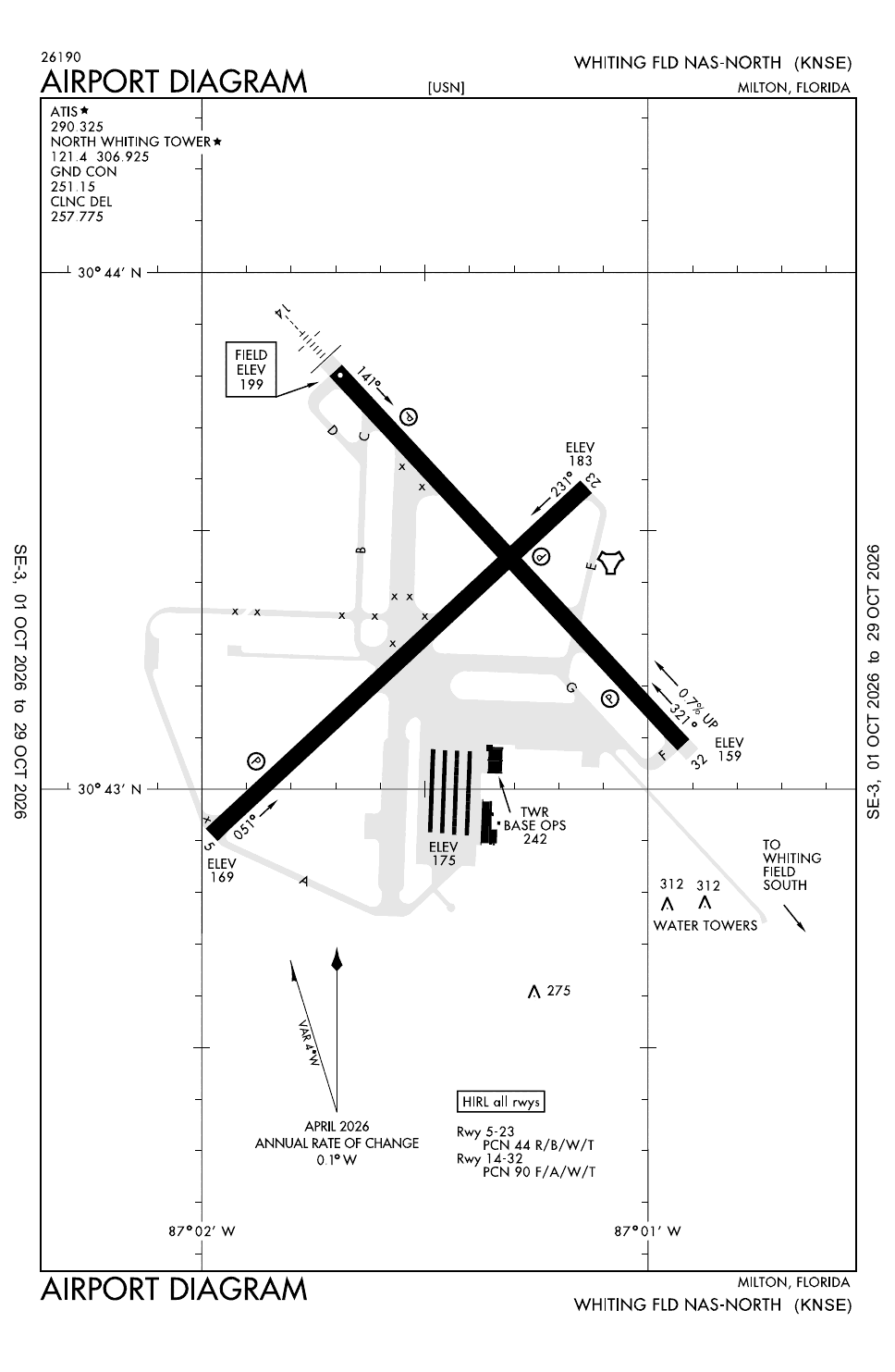
| North Field 05/23 [2] | 6,003 ft (1,830 m) | 200 ft (61 m) | asphalt |
| North Field 14/32 [2] | 6,001 ft (1,829 m) | 200 ft (61 m) | asphalt |
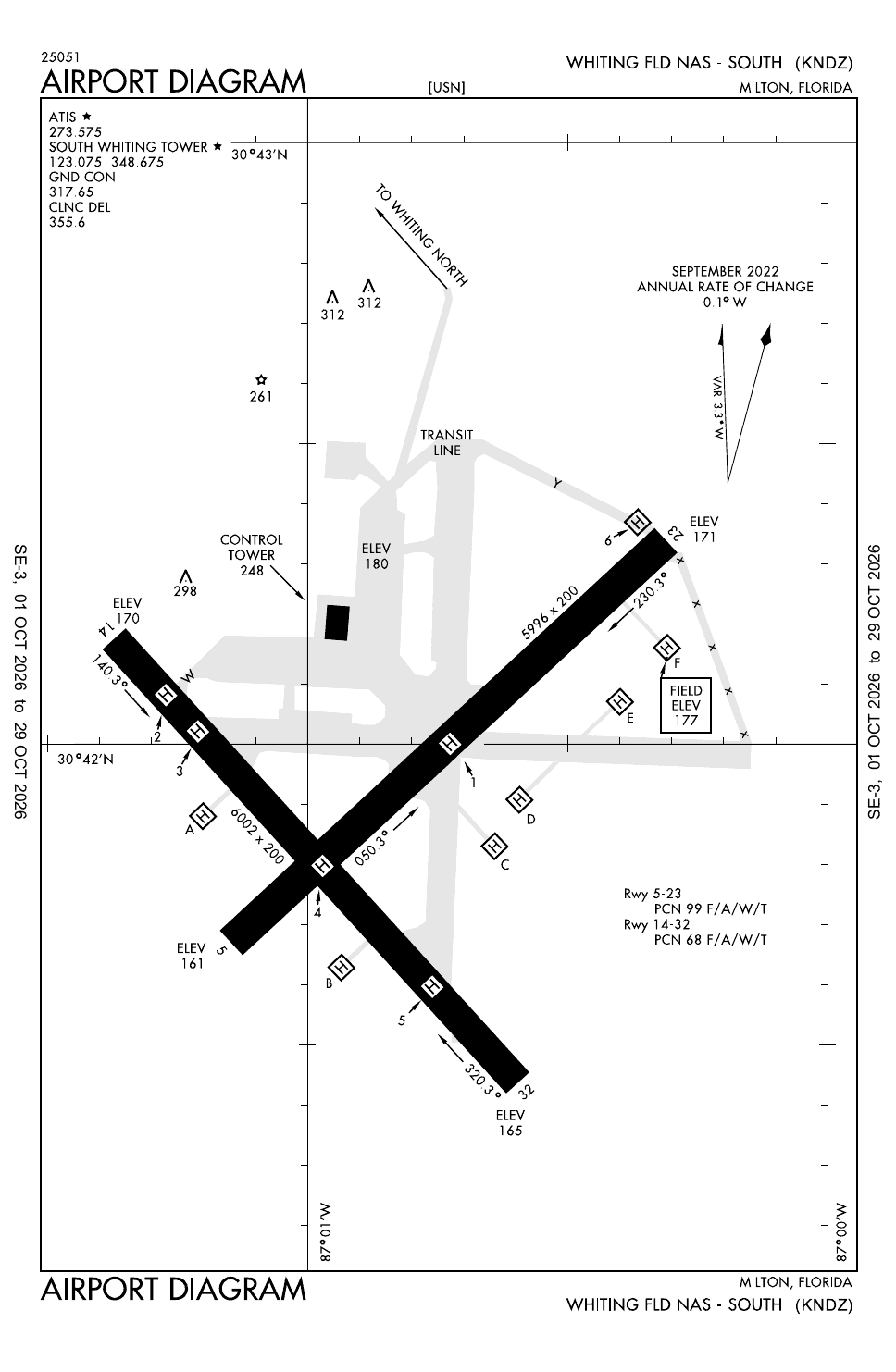
| South Field 05/23 [3] | 5,996 ft (1,828 m) | 200 ft (61 m) | asphalt |
| South Field 14/32 [3] | 6,002 ft (1,829 m) | 200 ft (61 m) | asphalt |
- Arresting gear
- None documented in the sources cited
- Navaids
- TACANTACAN GlossaryAirfield and ATC: Tactical air navigation. An ultra-high frequency electronic rho-theta air navigation aid which provides suitably equipped aircraft a continuous indication of bearing and distance to the TACAN station. NSE, on North Field, serving both fields [2]
- ILS/DME runway 14 at North Field (I-NSE) and runway 32 at South Field (I-NDZ) [2] [3]
Sim maps
Represented in: no map checked so far
No sim map has been checked against this airfield yet. That is not a claim that no map represents it.
Other maps in North America, not yet checked for this airfield, which may lie outside them: DCS: Nevada Test and Training Range.
Role today
Whiting Field is one of the Navy’s two primary pilot training bases, with NAS Corpus Christi, and it is two airfields that share one support base. [1] North Field is used only for primary training in the T-6B Texan II, flown by students of the Navy, Marine Corps, Coast Guard and Air Force on the joint primary syllabus, along with allied students. [1] South Field is the advanced helicopter school: Navy, Marine Corps, Coast Guard and allied students fly the TH-73A Thrasher there, and US students who finish it are designated naval aviators. [1] The station also has outlying fields in Santa Rosa County and near Navarre. [1]
History
Naval Auxiliary Air Station Whiting Field was commissioned on 16 July 1943 and named for Captain Kenneth Whiting, Naval Aviator No. 16, who learned to fly under Orville Wright in 1914 and helped convert the collier Jupiter into the Navy’s first aircraft carrier, USS Langley. [1] Jet training arrived in 1949 with eight TO-1 Shooting Stars, and the Blue Angels made Whiting their headquarters in 1955. [1] The first TH-73A Thrasher, an Italian-designed helicopter, reached Training Air Wing Five on 6 August 2021. [1]
Sources
- Naval Air Station Whiting Field. Wikipedia (secondary source). https://en.wikipedia.org/wiki/Naval_Air_Station_Whiting_Field (accessed 2026-10-27).
- Airport data: NSE (KNSE), Whiting Fld NAS-North. Federal Aviation Administration, Aeronautical Information Services, data effective 1–29 October 2026. https://nfdc.faa.gov/nfdcApps/services/ajv5/airportDisplay.jsp?airportId=NSE (accessed 2026-10-27).
- Airport data: NDZ (KNDZ), Whiting Fld NAS-South. Federal Aviation Administration, Aeronautical Information Services, data effective 1–29 October 2026. https://nfdc.faa.gov/nfdcApps/services/ajv5/airportDisplay.jsp?airportId=NDZ (accessed 2026-10-27).
- Airport Diagrams, Whiting Fld NAS-North (KNSE) and NAS-South (KNDZ). Federal Aviation Administration, digital Terminal Procedures Publication, cycle 2610, 1–29 October 2026. https://aeronav.faa.gov/d-tpp/2610/00602AD.PDF (accessed 2026-10-27). South Field: https://aeronav.faa.gov/d-tpp/2610/01909AD.PDF
- Airport data, KNSE. OurAirports open data (public domain, community-maintained). https://davidmegginson.github.io/ourairports-data/airports.csv (accessed 2026-10-28). Row for KNSE, North Field: latitude, longitude and identifiers.
Wikipedia articles are secondary sources and can change; they are cited with the date they were read. FAA airport data and diagrams are official but are reissued every 28 or 56 days; each is cited with the edition read. pydcs mirrors the DCS terrain data at the commit linked.