
Drafted — not technically validated
Record revision 1 · The Marine Corps' busiest air station: F-35B squadrons, the Weapons and Tactics Instructor course and desert ranges, sharing its field with Yuma International.
A real-world airfield as described in public sources, and how sim maps represent it. Units, facilities and names change; each is dated where the sources allow, and the charts are not for navigation. Use current official publications for flight planning.
Location and identity
- Country or territory
- United States
- Coordinates
- 32.6509° N, 114.6094° W [4]
- Elevation
- 213 ft (65 m) [2]
- Identifiers
- ICAO KNYL · IATA YUM · FAA NYL
- Other names
- Opened
- 1928, as Fly Field; Marine Corps since 1959, and Marine Corps Air Station Yuma from 20 July 1962 [1]
- Theatre
- North America
Role and operators
- Status
- Active · Joint military and civil
- Roles today
- Fighter and strike · Weapons and tactics school · Flight test · Civil airport
Units
Permanently based units belong to the airfield; rotational and temporarily deployed units are there for a period or an operation. Dates are when the sources place each unit there; "as of" is when a source described it as current.
Current
Marine Aircraft Group 13: VMFA-122, VMFA-211, VMFA-214 and VMFA-225 [1]
- Service
- United States, marines
- Basing
- Permanently based
- Aircraft
- F-35B Lightning II
- When
- as of Oct 2026
Marine Aviation Weapons and Tactics Squadron 1 (MAWTS-1), which runs the Weapons and Tactics Instructor course [1]
- Service
- United States, marines
- Basing
- Permanently based
- When
- as of Oct 2026
Marine Operational Test and Evaluation Squadron 1 (VMX-1) [1]
- Service
- United States, marines
- Basing
- Permanently based
- When
- as of Oct 2026
Marine Fighter Training Squadron 401 (VMFT-401), a reserve adversary squadron [1]
- Service
- United States, marines
- Basing
- Permanently based
- When
- as of Oct 2026
Runways and facilities
From data effective Oct 2026. Facilities not listed here are not documented in the sources cited, which does not mean the airfield lacks them.
| Runway | Length | Width | Surface |
|---|---|---|---|
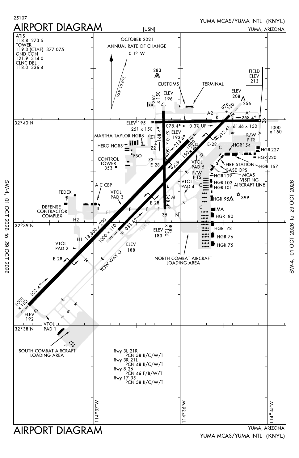
| 03L/21R [2] | 13,300 ft (4,054 m) | 200 ft (61 m) | concrete |
| 03R/21L [2] | 9,240 ft (2,816 m) | 150 ft (46 m) | asphalt and concrete |
| 08/26 [2] | 6,146 ft (1,873 m) | 150 ft (46 m) | asphalt |
| 17/35 [3] | 5,710 ft (1,740 m) | 150 ft (46 m) | Not given |
- Arresting gear
- E-28 on runways 03L/21R, 03R/21L and 17/35 [3]
- Navaids
Sim maps
Represented in: no map checked so far
No sim map has been checked against this airfield yet. That is not a claim that no map represents it.
Other maps in North America, not yet checked for this airfield, which may lie outside them: DCS: Nevada Test and Training Range.
Role today
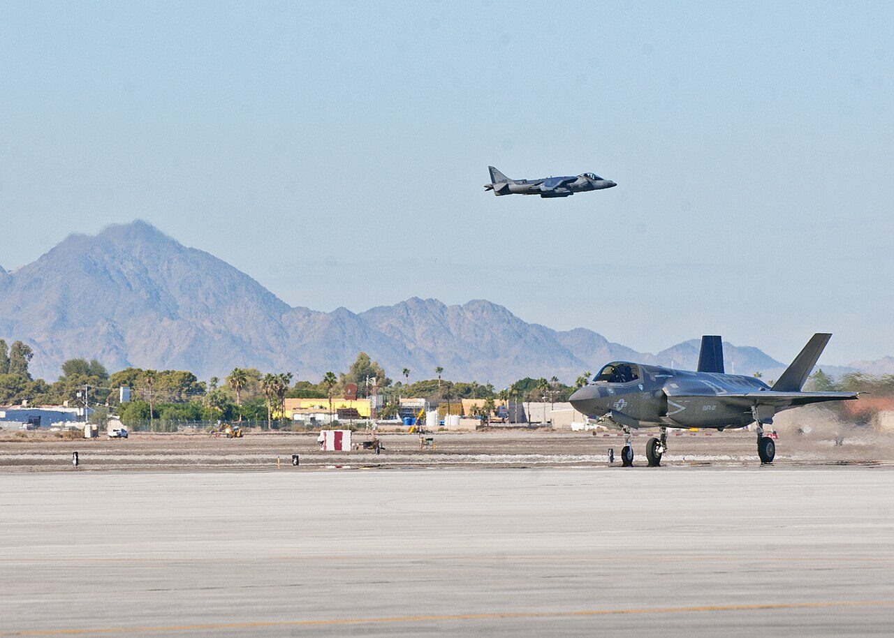
Yuma is the busiest air station in the Marine Corps. [1] Its desert weather allows flying almost all year, and the station sits beside large air-to-ground ranges, the Chocolate Mountain Aerial Gunnery Range and the western Barry M. Goldwater Range, with restricted airspace over them; it also runs an auxiliary airfield on the Goldwater range. [1] Marine Aviation Weapons and Tactics Squadron 1 trains all the Marine Corps’ tactical aviation units from here, above all through the Weapons and Tactics Instructor course, and VMFT-401 flies adversaries for every US service and for allied air forces. [1]
History
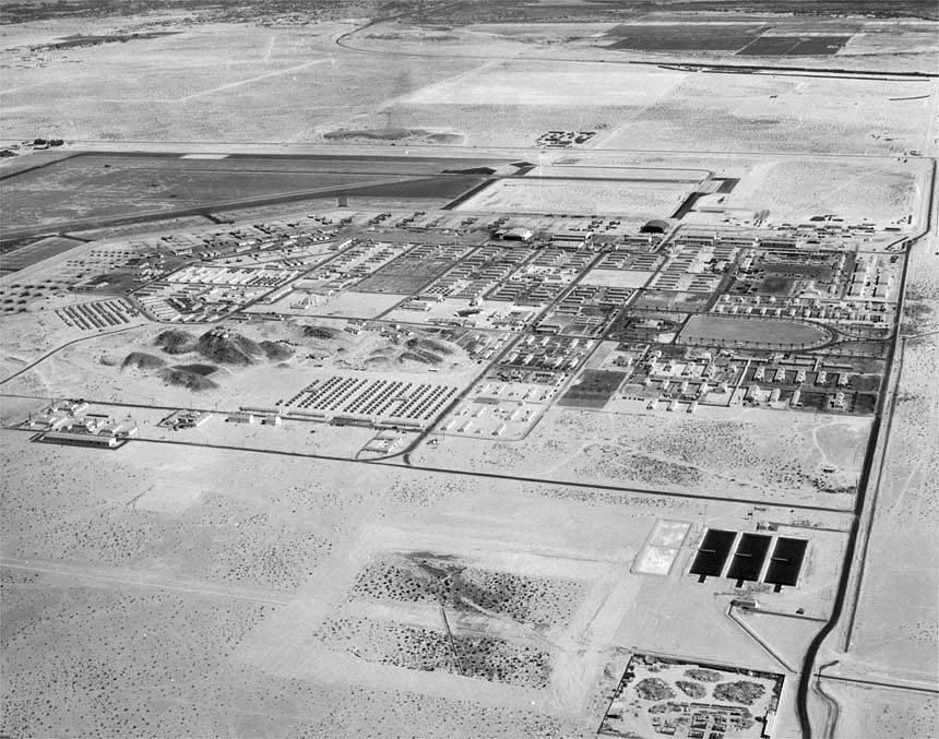
The field began in 1928 as Fly Field, named for Colonel Benjamin F. Fly, who had recommended the site. [1] In the Second World War it became Yuma Army Airfield, a flying school on AT-6s and later B-26 Marauders, with a flexible gunnery school. [1] The Air Force reopened it in 1954 for Air Defense Command’s interceptor crews, who came for two weeks at a time to fire rockets at towed targets, and named it Vincent Air Force Base in 1956. [1] The base passed to the Navy in 1959 and to the Marine Corps soon after, and it became Marine Corps Air Station Yuma on 20 July 1962. [1] It was home to the Marine Corps’ F-4F-4 Phantom II AircraftThe big two-seat Cold War fighter-bomber; the F-4E added an internal gun and slats after Vietnam. training squadron in the 1960s and 1970s and then to the Pacific AV-8B Harrier IIAV-8B Harrier II AircraftA vectored-thrust jump jet: vertical or short take-off, flown by the US Marines for close air support. force, and the Marine Corps’ first operational F-35B arrived on 16 November 2012. [1]

Sources
- Marine Corps Air Station Yuma. Wikipedia (secondary source). https://en.wikipedia.org/wiki/Marine_Corps_Air_Station_Yuma (accessed 2026-10-27).
- Airport data: NYL (KNYL), Yuma MCAS/Yuma Intl. Federal Aviation Administration, Aeronautical Information Services, data effective 1–29 October 2026. https://nfdc.faa.gov/nfdcApps/services/ajv5/airportDisplay.jsp?airportId=NYL (accessed 2026-10-27).
- Airport Diagram, Yuma MCAS/Yuma Intl (KNYL). Federal Aviation Administration, digital Terminal Procedures Publication, cycle 2610, 1–29 October 2026. https://aeronav.faa.gov/d-tpp/2610/00511AD.PDF (accessed 2026-10-27). Runway 17/35 is on the diagram but not in the airport data read the same day.
- Airport data, KNYL. OurAirports open data (public domain, community-maintained). https://davidmegginson.github.io/ourairports-data/airports.csv (accessed 2026-10-28). Row for KNYL: latitude, longitude and identifiers.
Wikipedia articles are secondary sources and can change; they are cited with the date they were read. FAA airport data and diagrams are official but are reissued every 28 or 56 days; each is cited with the edition read. pydcs mirrors the DCS terrain data at the commit linked.