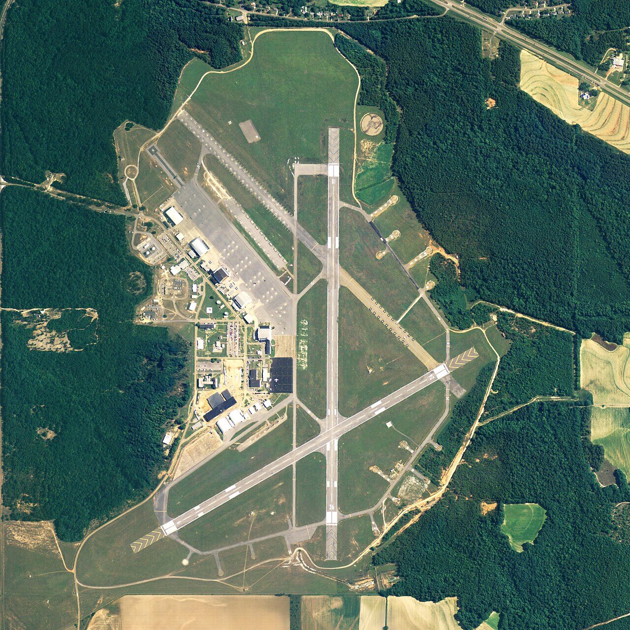

Drafted — not technically validated
Record revision 1 · The home of Army aviation in Alabama, where every Army aviator learns to fly; its Cairns Army Airfield is the Army's busiest.
A real-world airfield as described in public sources, and how sim maps represent it. Units, facilities and names change; each is dated where the sources allow, and the charts are not for navigation. Use current official publications for flight planning.
Location and identity
- Country or territory
- United States
- Coordinates
- 31.2757° N, 85.7134° W [5]
- Elevation
- 301 ft (92 m) [2]
- Identifiers
- ICAO KOZR · FAA OZR
- Other names
- Opened
- Camp Rucker opened on 1 May 1942; its airfield, Ozark Army Airfield, was built from September 1942 and became Cairns Army Airfield in January 1959 [1] [4]
- Theatre
- North America
Role and operators
- Status
- Active · Military
- Roles today
- Flight training · Helicopter operations
Units
Permanently based units belong to the airfield; rotational and temporarily deployed units are there for a period or an operation. Dates are when the sources place each unit there; "as of" is when a source described it as current.
Current
US Army Aviation Center of Excellence, with the 1st and 110th Aviation Brigades [1]
- Service
- United States, army
- Basing
- Permanently based
- When
- as of Oct 2026
1st Battalion, 223rd Aviation Regiment, for introductory helicopter training at Cairns [1]
- Service
- United States, army
- Basing
- Permanently based
- Aircraft
- UH-72 Lakota
- When
- as of Oct 2026
23rd Flying Training Squadron, which trains Air Force helicopter pilots [1] [4]
- Service
- United States, air force
- Basing
- Permanently based
- Aircraft
- TH-1H
- When
- as of Oct 2026
The Warrant Officer Candidate School and Warrant Officer Career College [1]
- Service
- United States, army
- Basing
- Permanently based
- When
- as of Oct 2026
Runways and facilities
From data effective Oct 2026. Facilities not listed here are not documented in the sources cited, which does not mean the airfield lacks them.
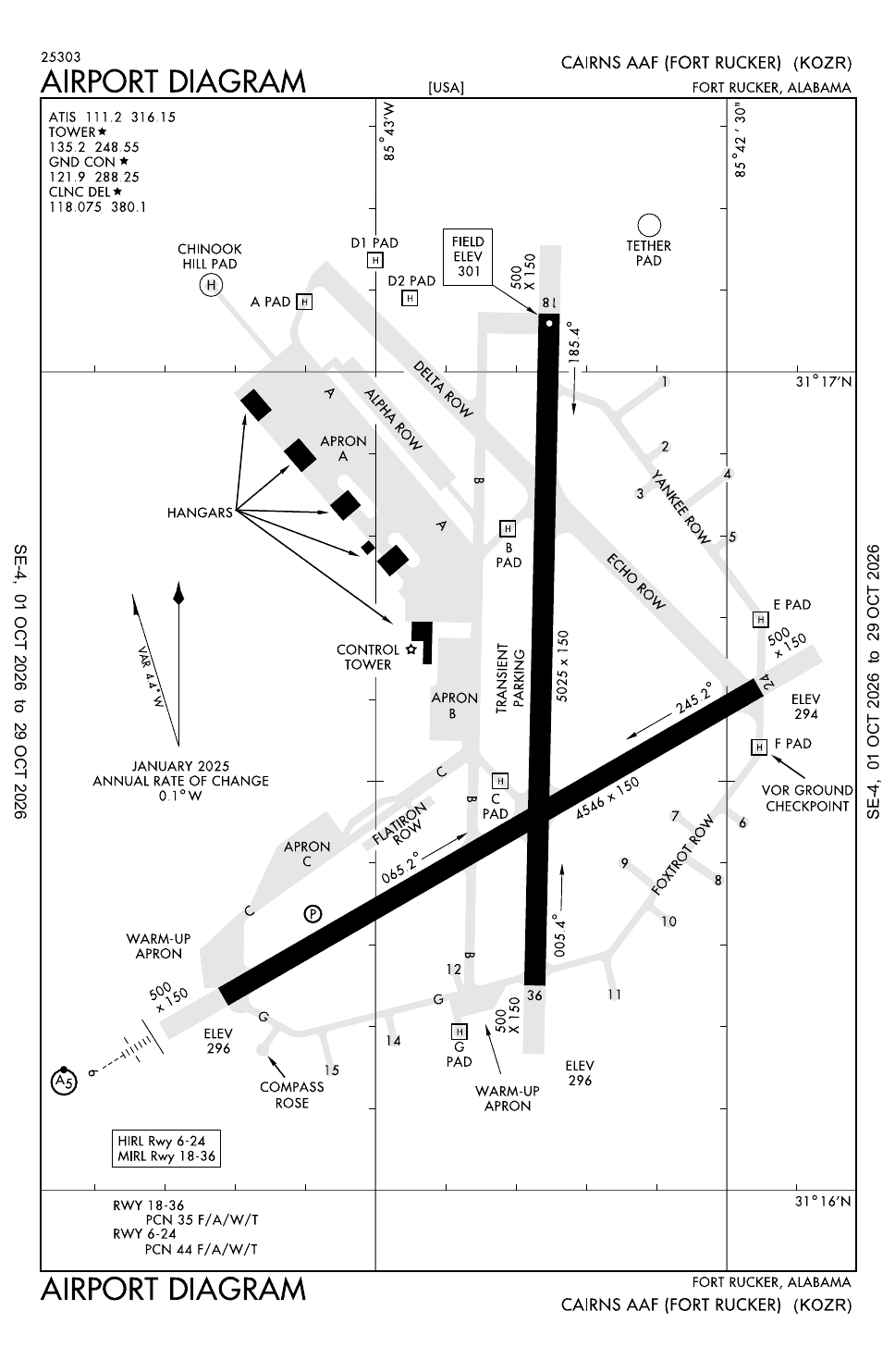
| Runway | Length | Width | Surface |
|---|---|---|---|
| 06/24 [2] | 4,546 ft (1,386 m) | 150 ft (46 m) | asphalt |
| 18/36 [2] | 5,025 ft (1,532 m) | 150 ft (46 m) | asphalt |
- Arresting gear
- None documented in the sources cited
Sim maps
Represented in: no map checked so far
No sim map has been checked against this airfield yet. That is not a claim that no map represents it.
Other maps in North America, not yet checked for this airfield, which may lie outside them: DCS: Nevada Test and Training Range.
Role today
Fort Rucker is the home of Army aviation. [1] Every Army aviator learns to fly here, and all Army aviation training has been done at Fort Rucker since 1973, along with the training of Air Force and allied helicopter pilots and crews. [1] The post holds the US Army Aviation Center of Excellence, which covers aviation training, doctrine and testing, as well as the Army Aviation Museum. [1] Because so many aviators are warrant officers, the Warrant Officer Candidate School is here too, and aviation warrant officers stay on for flight school before they receive their wings. [1]
Training fields
Training is spread over several fields. [1] At Cairns Army Airfield, 1st Battalion, 223rd Aviation Regiment teaches new pilots on the UH-72 Lakota, which replaced the TH-67 Creek trainer, the last of which retired in 2021. [1] Advanced training happens at the heliports: AH-64E Apache training from Hanchey Army Heliport, UH-60 Black Hawk combat and night training from Lowe and Shell, and CH-47CH-47F Chinook AircraftThe tandem-rotor heavy-lift helicopter that has carried troops, guns and supplies for every war since Vietnam. Chinook training from Knox. [1] The Air Force’s 23rd Flying Training Squadron trains its helicopter pilots at Cairns, in the TH-1H. [4]
Cairns is the Army’s busiest airfield, with about 240,000 aircraft movements a year; its tower may launch 70 to 120 aircraft in the morning and afternoon and 50 or 60 more at night. [4] The field was built in 1942 as Ozark Army Airfield, a wartime training field; it was released by the Air Force after the war, used in 1949 to film the airfield scenes of Twelve O’Clock High, and taken over by the Army in 1952. [4] It was renamed in 1959 for Major General Bogardus S. Cairns, commander of the Aviation Center, who was killed in an H-13 helicopter crash near the post in December 1958. [4]
Name
The post itself has changed its name twice in recent years: it was Fort Novosel, for Medal of Honor helicopter pilot Michael J. Novosel, from April 2023, and became Fort Rucker again on 11 June 2025, now named for Captain Edward W. Rucker, a First World War aviator. [1]
Sources
- Fort Rucker. Wikipedia (secondary source). https://en.wikipedia.org/wiki/Fort_Rucker (accessed 2026-10-27).
- Airport data: OZR (KOZR), Cairns AAF (Fort Rucker). Federal Aviation Administration, Aeronautical Information Services, data effective 1–29 October 2026. https://nfdc.faa.gov/nfdcApps/services/ajv5/airportDisplay.jsp?airportId=OZR (accessed 2026-10-27).
- Airport Diagram, Cairns AAF (Fort Rucker) (KOZR). Federal Aviation Administration, digital Terminal Procedures Publication, cycle 2610, 1–29 October 2026. https://aeronav.faa.gov/d-tpp/2610/00577AD.PDF (accessed 2026-10-27).
- Cairns Army Airfield. Wikipedia (secondary source). https://en.wikipedia.org/wiki/Cairns_Army_Airfield (accessed 2026-10-27).
- Airport data, KOZR. OurAirports open data (public domain, community-maintained). https://davidmegginson.github.io/ourairports-data/airports.csv (accessed 2026-10-28). Row for KOZR: latitude, longitude and identifiers.
Wikipedia articles are secondary sources and can change; they are cited with the date they were read. FAA airport data and diagrams are official but are reissued every 28 or 56 days; each is cited with the edition read. pydcs mirrors the DCS terrain data at the commit linked.