
Drafted — not technically validated
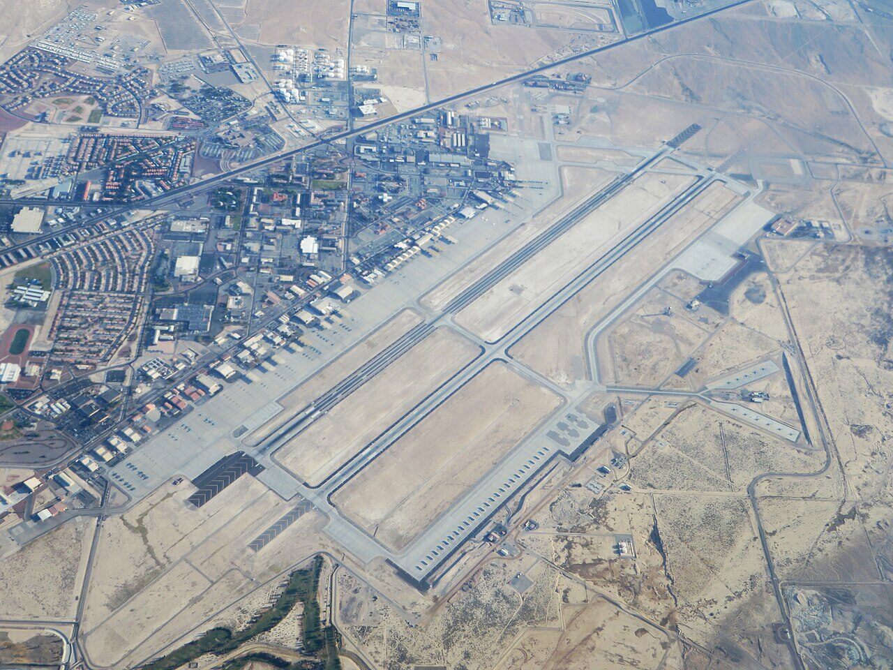
Record revision 1 · The Air Force's centre for advanced combat training: home of the Weapons School, Red Flag and the Thunderbirds, outside Las Vegas.
A real-world airfield as described in public sources, and how sim maps represent it. Units, facilities and names change; each is dated where the sources allow, and the charts are not for navigation. Use current official publications for flight planning.
Location and identity
- Country or territory
- United States
- Coordinates
- 36.2362° N, 115.0340° W [6]
- Elevation
- 1,869 ft (570 m) [2]
- Identifiers
- ICAO KLSV · IATA LSV · FAA LSV
- Other names
- Las Vegas Army Airfield (former name, 20 Dec 1941 – 30 Apr 1950) [1]
- Opened
- 20 December 1941, as Las Vegas Army Airfield; named Nellis Air Force Base on 30 April 1950 [1]
- Theatre
- North America
Role and operators
- Status
- Active · Military
- Roles today
- Fighter and strike · Weapons and tactics school · Flight test
- Operators
- US Air Force, Air Combat Command · United States, air force · current; start date not given [1]
Units
Permanently based units belong to the airfield; rotational and temporarily deployed units are there for a period or an operation. Dates are when the sources place each unit there; "as of" is when a source described it as current.
Current
US Air Force Warfare Center, with the 99th Air Base Wing as host [1]
- Service
- United States, air force
- Basing
- Permanently based
- When
- as of Oct 2026
57th Wing: the US Air Force Weapons School and the Thunderbirds demonstration squadron [1]
- Service
- United States, air force
- Basing
- Permanently based
- Aircraft
- F-16
- When
- as of Oct 2026
53rd Wing test and evaluation units, the 505th Command and Control Wing and the 926th Wing (Air Force Reserve) [1]
- Service
- United States, air force
- Basing
- Permanently based
- When
- as of Oct 2026
Red Flag and Green Flag-West exercise forces from the US services and allied air forces [1]
- Service
- United States, joint or defence-wide
- Basing
- Temporarily deployed
- When
- date not given
Runways and facilities
From data effective Oct 2026. Facilities not listed here are not documented in the sources cited, which does not mean the airfield lacks them.
| Runway | Length | Width | Surface |
|---|---|---|---|
| 03L/21R [2] | 10,120 ft (3,085 m) | 200 ft (61 m) | concrete |
| 03R/21L [2]ALSF-1 approach lights at both ends | 10,051 ft (3,064 m) | 150 ft (46 m) | concrete |
- Arresting gear
- Navaids
- TACANTACAN GlossaryAirfield and ATC: Tactical air navigation. An ultra-high frequency electronic rho-theta air navigation aid which provides suitably equipped aircraft a continuous indication of bearing and distance to the TACAN station. LSV, on the field [2]
- ILS runway 21L (I-DIQ) [2]
- PAPIsPAPI GlossaryAirfield and ATC: Precision approach path indicator. A visual glide slope indicator of two or four light units in a single row, normally on the left side of the runway. Each unit shows red or white depending on whether the aircraft is… set for a 3° glide path at all four runway ends [2] [3]
- Other
- Ramp space for up to 300 aircraft, for large exercise deployments [1]
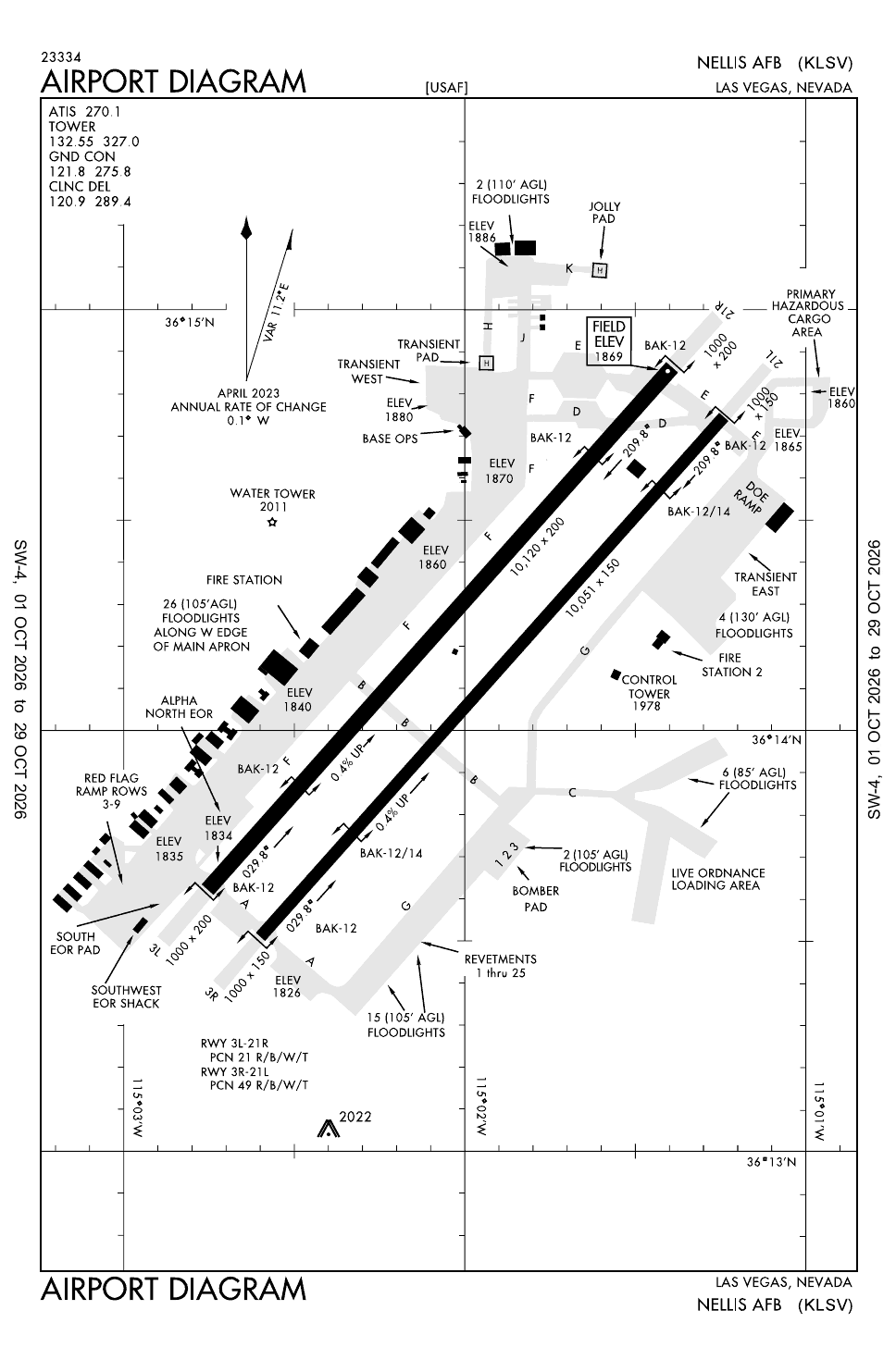
Figure 1 — Airfield map of Nellis Air Force Base (to scale)
- Runway
- Taxiway, with its name
- Apron
- Hangar or terminal
- Helipad
- Airfield boundary
Runways, taxiways, aprons and buildings inside the airfield boundary, true north up, drawn from OpenStreetMap data retrieved 2026-11-01. Widths come from the map data or, where it gives none, a typical 45 m runway and 18 m taxiway. Map data © OpenStreetMap contributors, available under the ODbL 1.0. Community-mapped, not an official aerodrome chart, and not for navigation.
Sim maps
Represented in: DCS: Nevada Test and Training Range
DCS: Nevada Test and Training Range DCS World · Present day
Only the maps marked represented or confirmed absent have been checked. Any other map may or may not represent this airfield.
Role today
Nellis calls itself the “Home of the Fighter Pilot” and is the Air Force’s centre for advanced combat training. [1] Its main unit, the US Air Force Warfare Center, runs exercises that bring strikeStrike GlossaryJoint terms: An attack to damage or destroy an objective or a capability. packages from across the Air Force together with Army, Navy and Marine Corps units and allied air forces, chiefly Red Flag and Green Flag-West, flown over the Nevada Test and Training RangeNorth America TheatreUS home ranges, led by the Nevada Test and Training Range: Red Flag, nuclear tests, Area 51 and the F-117’s secret years. north of the base. [1] Range traffic works with “Nellis Control” for the restricted areas and the Desert MOA. [2]
History
The field began as a Western Air Express mail strip that the City of Las Vegas bought in January 1941 and split between the Army and the city. [1] Las Vegas Army Airfield opened on 20 December 1941 as a flexible gunnery school and trained more than 45,000 B-17 gunners in the Second World War. [1] After a spell as a P-51P-51D Mustang AircraftThe long-range escort fighter that took US bombers to Berlin and back; Merlin-powered, with six .50 calibre guns. pilot training base it was named in 1950 for 1st Lt. William Harrell Nellis, killed in action in Europe in 1944, and the Fighter Weapons School formed there in 1954. [1] The school struggled with its F-86sF-86 Sabre AircraftThe swept-wing day fighter that met the MiG-15 over Korea. in the mid-1950s; under Tactical Air Command from 1958 it moved to graduate-level weapons training on the F-100F-100 Super Sabre AircraftThe first US Air Force fighter supersonic in level flight; a fighter-bomber and fast FAC in Vietnam., F-105 and F-4F-4 Phantom II AircraftThe big two-seat Cold War fighter-bomber; the F-4E added an internal gun and slats after Vietnam.. [1]
From the 1970s Nellis added the pieces of modern combat training: aggressor squadronsSquadron GlossaryJoint terms: 1. An organization consisting of two or more divisions of ships, or two or more divisions (Navy) or flights of aircraft. 2. The basic administrative aviation unit of the Army, Navy, Marine Corps, and Air Force. 3… flying dissimilar aircraft, the 4477th “Red Eagles” flying MiGs from the Tonopah Test Range, and Red Flag itself, run by the 57th wing from 1979. [1] The Weapons School now teaches instructors for most Air Force combat aircraft, from fighters to the B-1, B-52 and rescue helicopters, and the Thunderbirds have flown from Nellis since 1956. [1]
Sources
- Nellis Air Force Base. Wikipedia (secondary source). https://en.wikipedia.org/wiki/Nellis_Air_Force_Base (accessed 2026-10-27).
- Airport data: LSV (KLSV), Nellis AFB. Federal Aviation Administration, Aeronautical Information Services, data effective 1–29 October 2026. https://nfdc.faa.gov/nfdcApps/services/ajv5/airportDisplay.jsp?airportId=LSV (accessed 2026-10-27).
- Airport Diagram, Nellis AFB (KLSV). Federal Aviation Administration, digital Terminal Procedures Publication, cycle 2610, 1–29 October 2026. https://aeronav.faa.gov/d-tpp/2610/00227AD.PDF (accessed 2026-10-27).
- DCS: Nevada Test and Training Range Map. Eagle Dynamics (product page). https://www.digitalcombatsimulator.com/en/shop/terrains/nttr_terrain/ (accessed 2026-10-27).
- pydcs terrain data: Nevada airports (airports.py). pydcs, an open-source Python library for building DCS World missions, whose terrain data mirrors the game's. https://github.com/pydcs/dcs/blob/5ddcc63a2dcd661e16b14f7aa43219b93044855d/dcs/terrain/nevada/airports.py (accessed 2026-10-27). Nellis entry: ATC radios, runways and runway beacons.
- Airport data, KLSV. OurAirports open data (public domain, community-maintained). https://davidmegginson.github.io/ourairports-data/airports.csv (accessed 2026-10-28). Row for KLSV: latitude, longitude and identifiers.
Wikipedia articles are secondary sources and can change; they are cited with the date they were read. FAA airport data and diagrams are official but are reissued every 28 or 56 days; each is cited with the edition read. pydcs mirrors the DCS terrain data at the commit linked.