Drafted — not technically validated
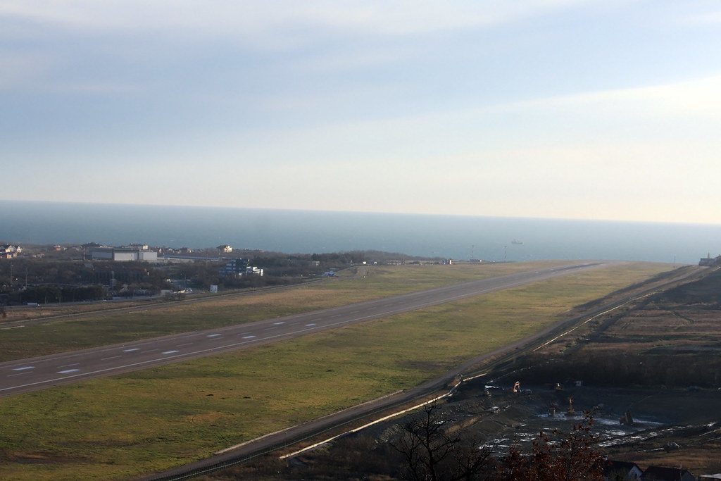
Record revision 1 · A resort airport on Gelendzhik Bay, a Black Sea Fleet airfield after the war, rebuilt with a 3,100 m runway in 2010.
A real-world airfield as described in public sources, and how sim maps represent it. Units, facilities and names change; each is dated where the sources allow, and the charts are not for navigation. Use current official publications for flight planning.
Location and identity
- Location
- Within Gelendzhik, on the west shore of Gelendzhik Bay at Tonky Mys, Krasnodar Krai [2]
- Country or territory
- Russia
- Coordinates
- 44.5821° N, 38.0125° E [3]
- Identifiers
- ICAO URKG · IATA GDZ
- Other names
- None recorded
- Opened
- a military airfield, Solntsedar, was built on the edge of Gelendzhik just after the Second World War and handed to civil aviation after rebuilding in 1956 [2]
- Theatre
- The Caucasus
Role and operators
- Status
- Active · Civil
- Roles today
- Civil airport
Runways and facilities
The sources do not date these figures. Facilities not listed here are not documented in the sources cited, which does not mean the airfield lacks them.
| Runway | Length | Width | Surface |
|---|---|---|---|
| 01/19 [1] [2] [3]3,100 × 45 m, built in a rebuilding decided in 2004 and first used in December 2008 | 10,171 ft (3,100 m) | 148 ft (45 m) | asphalt |
- Arresting gear
- None documented in the sources cited
- Navaids
- None documented in the sources cited
Figure 1 — Airfield map of Gelendzhik Airport (to scale)
- Runway
- Taxiway, with its name
- Apron
- Hangar or terminal
- Helipad
- Airfield boundary
Runways, taxiways, aprons and buildings inside the airfield boundary, true north up, drawn from OpenStreetMap data retrieved 2026-10-28. Widths come from the map data or, where it gives none, a typical 45 m runway and 18 m taxiway. Map data © OpenStreetMap contributors, available under the ODbL 1.0. Community-mapped, not an official aerodrome chart, and not for navigation.
Sim maps
Represented in: DCS: Caucasus
DCS: Caucasus DCS World · Present day
Represented as “Gelendzhik” · checked 2026-10-28 [4]
Only the maps marked represented or confirmed absent have been checked. Any other map may or may not represent this airfield.
Role today
Gelendzhik serves the resort town and nearby Novorossiysk; it reopened to passenger flights on 18 July 2025 after three years closed following Russia’s invasion of Ukraine. [1] [2] The town also has Gelendzhik-Bukhta, a seaplane aerodrome on the bay belonging to the Beriev aircraft company’s test base. [2]
History
Before the Second World War the Black Sea Fleet air force’s 83rd Independent Reconnaissance Squadron was based around Gelendzhik. [2] Just after the war the Solntsedar airfield was built on the edge of the town for the fleet’s aviation; after rebuilding in 1956 it passed to civil aviation and served Aeroflot as Gelendzhik’s airport, with An-24s, Yak-40s and L-410s. [2] On 7 January 1982 an Aeroflot L-410M crashed near the airport, killing 18. [2]
In 2004 a complete rebuilding was decided, with a new terminal and a new 3,100 m runway; the first aircraft used the runway on 25 December 2008, and the first scheduled flight, an Aeroflot A320 from Moscow, landed on 29 May 2010. [2]
The airfield
A single asphalt runway, 01/19, 3,100 m long and 45 m wide. [1] [2]
Sources
- Gelendzhik Airport. Wikipedia (secondary source). https://en.wikipedia.org/wiki/Gelendzhik_Airport (accessed 2026-10-28).
- Геленджик (аэропорт) (Gelendzhik airport). Russian Wikipedia (secondary source, in Russian). https://ru.wikipedia.org/wiki/Геленджик_(аэропорт) (accessed 2026-10-28). History from the 1930s, the 2004–2010 rebuilding and the seaplane base. Its uncited wartime claims are not repeated here.
- Airport and runway data, URKG. OurAirports open data (public domain, community-maintained). https://davidmegginson.github.io/ourairports-data/airports.csv (accessed 2026-10-28). Rows for URKG in airports.csv and runways.csv.
- dcs-world-schema reference data: Caucasus airbases (Gelendzhik.json). dcs-world-schema, open-source data extracted by running DCS World 2.9.30.28536. https://github.com/YoloWingPixie/dcs-world-schema/blob/c3091e6c08fb8167e26145d0e33c10e4140c6fe7/dcs-world-reference/latest/airbases/Caucasus/Gelendzhik.json (accessed 2026-10-28). With its beacon and navaid files, as tabled on the DCS: Caucasus map page.
Wikipedia articles are secondary sources and can change; they are cited with the date they were read. FAA airport data and diagrams are official but are reissued every 28 or 56 days; each is cited with the edition read. pydcs mirrors the DCS terrain data at the commit linked.