Drafted — not technically validated
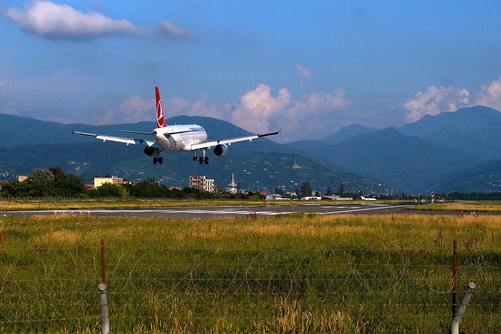
Record revision 1 · Georgia's Black Sea airport south of Batumi: a Soviet fighter base from 1940 to 1960, now a civil airport run by TAV.
A real-world airfield as described in public sources, and how sim maps represent it. Units, facilities and names change; each is dated where the sources allow, and the charts are not for navigation. Use current official publications for flight planning.
Location and identity
- Location
- 2 km south of Batumi on the Black Sea coast, in the Autonomous Republic of Adjara in south-west Georgia, 20 km north-east of Hopa in Turkey [1]
- Country or territory
- Georgia
- Coordinates
- 41.6094° N, 41.6003° E [3]
- Identifiers
- ICAO UGSB · IATA BUS
- Opened
- a military airfield by August 1940, when a Soviet fighter regiment was based there [2]
- Theatre
- The Caucasus
Role and operators
- Status
- Active · Civil
- Roles today
- Civil airport
Units
Permanently based units belong to the airfield; rotational and temporarily deployed units are there for a period or an operation. Dates are when the sources place each unit there; "as of" is when a source described it as current.
Earlier
35th Fighter Aviation Regiment, defending the Batumi area in the Second World War [2]
- Service
- Soviet Union (until 1991), air force
- Basing
- Permanently based
- Aircraft
- I-153, MiG-3, LaGG-3, Hurricane, P-40 Kittyhawk, Spitfire IX
- When
- Aug 1940 – 1944
833rd Fighter Aviation Regiment of the Air Defence Forces [2]
- Service
- Soviet Union (until 1991), air force
- Basing
- Permanently based
- Aircraft
- Yak-9, Spitfire IX, MiG-15, MiG-17
- When
- 7 Feb 1946 – 4 Oct 1953
705th Guards Fighter Aviation Regiment, disbanded at Batumi in the Soviet armed forces' reductions [2]
- Service
- Soviet Union (until 1991), air force
- Basing
- Permanently based
- Aircraft
- MiG-17
- When
- 1953 – Jun 1960
Runways and facilities
The sources do not date these figures. Facilities not listed here are not documented in the sources cited, which does not mean the airfield lacks them.
- Arresting gear
- None documented in the sources cited
- Navaids
- None documented in the sources cited
Figure 1 — Airfield map of Batumi International Airport (to scale)
- Runway
- Taxiway, with its name
- Apron
- Hangar or terminal
- Airfield boundary
Runways, taxiways, aprons and buildings inside the airfield boundary, true north up, drawn from OpenStreetMap data retrieved 2026-10-28. Widths come from the map data or, where it gives none, a typical 45 m runway and 18 m taxiway. Map data © OpenStreetMap contributors, available under the ODbL 1.0. Community-mapped, not an official aerodrome chart, and not for navigation.
Sim maps
Represented in: DCS: Caucasus
DCS: Caucasus DCS World · Present day
Represented as “Batumi” · checked 2026-10-28 [4]
- Runway 13/31, 6,793 ft, on the coast just south of the city [4]
- Tower 131.0 MHz VHF and 260.0 MHz UHF [4]
- TACAN 16X (BTM), an NDB (LU) and an ILS on runway 13, 110.3 MHz (ILU) [4]
Differences from the real airfield
Only the maps marked represented or confirmed absent have been checked. Any other map may or may not represent this airfield.
Role today
Batumi is Georgia’s international airport on the Black Sea coast, one of the country’s three international airports with TbilisiTbilisi International Airport AirfieldGeorgia's busiest airport, opened in 1952 and run by TAV since 2005. and KutaisiKutaisi International Airport AirfieldGeorgia's second airport, the former Soviet Kopitnari airfield of ground-attack, fighter and Su-24 bomber regiments.. [1] Its terminal opened on 26 May 2007 and was enlarged between 2019 and 2021 to handle 1.2 million passengers a year. [1] It has no based military flying unit today.
History
The airfield was military first. A Soviet fighter regiment, the 35th, was based there from August 1940 with I-153 biplanes and defended the Batumi area through the Second World War, flying MiG-3s, LaGG-3s and Lend-Lease Hurricanes, Kittyhawks and Spitfires before moving to Tbilisi in 1944. [2] The 833rd Fighter Regiment of the Air DefenceAir defense GlossaryJoint terms: Defensive measures designed to destroy attacking enemy aircraft or missiles in the atmosphere, or to nullify or reduce the effectiveness of such attack. Forces followed from February 1946 with Yak-9s and Spitfires, then MiG-15sMiG-15 AircraftThe Soviet swept-wing jet fighter that shocked UN air forces over Korea, armed with 37 mm and 23 mm cannon. and MiG-17s, until it left for East Germany in October 1953. [2] The 705th Guards Fighter Regiment arrived in its place, took over MiG-17s from a regiment at nearby KobuletiOzurgeti Air Base (Kobuleti) AirfieldThe disused airfield inland from Kobuleti that DCS models as a working base; little published history survives., and flew them until it was disbanded at Batumi in June 1960 as the Soviet armed forces were cut. [2]
On 25 October 2000 an Il-18 returning personnel and families to Russia’s 12th Military Base in Batumi flew into Mount Mtirala north-east of the city on its final approachFinal approach GlossaryAirfield and ATC: A flight path in the direction of landing along the extended runway centerline. The final approach normally extends from the base leg to the runway. An aircraft making a straight-in approach VFR is also considered to be…, killing all 84 aboard; the cause was a navigation error by the crew and inadequate control by air traffic services. [1] A Yak-40 on a flight from Yerevan had struck the same mountain while going aroundGo around GlossaryAirfield and ATC: Instructions for a pilot to abandon his/her approach to landing. Unless otherwise advised by ATC, a VFR aircraft or an aircraft conducting visual approach should overfly the runway while climbing to traffic pattern… in 1975. [2]
The airfield
A single runway, 12/30, 2,500 m long, runs along the coast south of the city. [1] [3] Mountains rise close inland, which the two accidents on Mount Mtirala show. [1] [2]
Sources
- Batumi International Airport. Wikipedia (secondary source). https://en.wikipedia.org/wiki/Batumi_International_Airport (accessed 2026-10-28).
- Международный аэропорт Батуми имени Александра Картвели (Batumi International Airport). Russian Wikipedia (secondary source, in Russian). https://ru.wikipedia.org/wiki/Батуми_(аэропорт) (accessed 2026-10-28). History section: the Soviet fighter regiments based at the airfield from 1940 to 1960, citing M. Holm's order-of-battle pages on ww2.dk.
- Airport and runway data, UGSB. OurAirports open data (public domain, community-maintained). https://davidmegginson.github.io/ourairports-data/airports.csv (accessed 2026-10-28). Rows for UGSB in airports.csv and runways.csv: position, elevation and runway 12/30.
- dcs-world-schema reference data: Caucasus airbases (Batumi.json). dcs-world-schema, open-source data extracted by running DCS World 2.9.30.28536. https://github.com/YoloWingPixie/dcs-world-schema/blob/c3091e6c08fb8167e26145d0e33c10e4140c6fe7/dcs-world-reference/latest/airbases/Caucasus/Batumi.json (accessed 2026-10-28). With its beacon and navaid files, as tabled on the DCS: Caucasus map page.
Wikipedia articles are secondary sources and can change; they are cited with the date they were read. FAA airport data and diagrams are official but are reissued every 28 or 56 days; each is cited with the edition read. pydcs mirrors the DCS terrain data at the commit linked.