Drafted — not technically validated
Record revision 1 · Georgia's second airport, the former Soviet Kopitnari airfield of ground-attack, fighter and Su-24 bomber regiments.
A real-world airfield as described in public sources, and how sim maps represent it. Units, facilities and names change; each is dated where the sources allow, and the charts are not for navigation. Use current official publications for flight planning.
Location and identity
- Location
- 14 km west of Kutaisi, in the Imereti region of western Georgia [1]
- Country or territory
- Georgia
- Coordinates
- 42.1774° N, 42.4854° E [3]
- Identifiers
- ICAO UGKO · IATA KUT
- Opened
- a Soviet military airfield, Kopitnari, by 1947, when a ground-attack regiment was based there [2]
- Theatre
- The Caucasus
Role and operators
- Status
- Active · Civil
- Roles today
- Civil airport
Units
Permanently based units belong to the airfield; rotational and temporarily deployed units are there for a period or an operation. Dates are when the sources place each unit there; "as of" is when a source described it as current.
Earlier
166th Guards Ground-Attack Aviation Regiment [2]
- Service
- Soviet Union (until 1991), air force
- Basing
- Permanently based
- Aircraft
- Il-10
- When
- 1947 – Apr 1954
167th Guards Fighter Aviation Regiment of the Air Defence Forces, disbanded at the airfield [2]
- Service
- Soviet Union (until 1991), air force
- Basing
- Permanently based
- Aircraft
- MiG-17, Su-9
- When
- 1960–1976
143rd Bomber Aviation Regiment, withdrawn to Morozovsk in Russia [2]
- Service
- Soviet Union (until 1991), air force
- Basing
- Permanently based
- Aircraft
- Il-28, Yak-28, Su-24M
- When
- 1961–1993
Runways and facilities
The sources do not date these figures. Facilities not listed here are not documented in the sources cited, which does not mean the airfield lacks them.
- Arresting gear
- None documented in the sources cited
- Navaids
- None documented in the sources cited
Figure 1 — Airfield map of Kutaisi International Airport (to scale)
- Runway
- Taxiway, with its name
- Apron
- Hangar or terminal
- Airfield boundary
Runways, taxiways, aprons and buildings inside the airfield boundary, true north up, drawn from OpenStreetMap data retrieved 2026-10-28. Widths come from the map data or, where it gives none, a typical 45 m runway and 18 m taxiway. Map data © OpenStreetMap contributors, available under the ODbL 1.0. Community-mapped, not an official aerodrome chart, and not for navigation.
Sim maps
Represented in: DCS: Caucasus
DCS: Caucasus DCS World · Present day
Represented as “Kutaisi” · checked 2026-10-28 [4]
Only the maps marked represented or confirmed absent have been checked. Any other map may or may not represent this airfield.
Role today
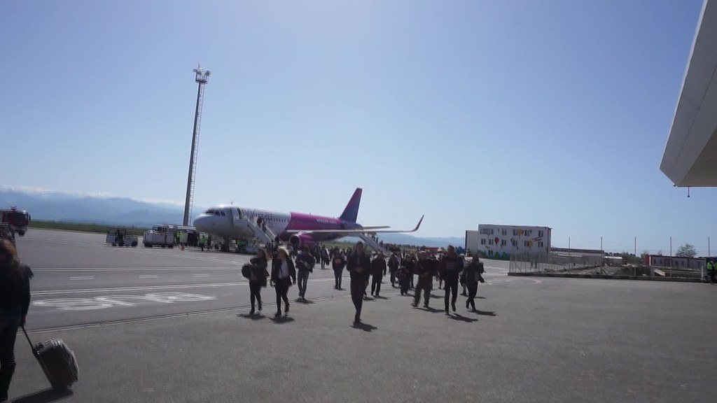
Kutaisi is Georgia’s second-busiest airport, with 1.7 million passengers in 2024, run by the state-owned United Airports of Georgia and built up around low-cost airlines, Wizz Air above all. [1] It lies beside the main road between Kutaisi and Batumi, and since 2022 trains between Tbilisi and Batumi stop at the nearby Kopitnari station. [1]
History
Before it was a civil airport it was Kopitnari, a Soviet military airfield. [2] The 166th Guards Ground-Attack Regiment flew Il-10s from it from 1947 until April 1954. [2] From 1960 the Air Defence Forces’ 167th Guards Fighter Regiment was based there with MiG-17s and Su-9s until it was disbanded in 1976, and from 1961 the 143rd Bomber Regiment flew Il-28s, then Yak-28s from 1966 and Su-24Ms, until it was withdrawn to Morozovsk in Russia in 1993. [2]
The airport closed for rebuilding in November 2011 and reopened on 27 September 2012, with Wizz Air flying in from Kyiv on the first day; in February 2016 Wizz Air announced a base there. [1] [2]
The airfield
One runway, 07/25, 2,500 m long and paved in asphalt. [1]
Sources
- Kutaisi International Airport. Wikipedia (secondary source). https://en.wikipedia.org/wiki/Kutaisi_International_Airport (accessed 2026-10-28).
- Кутаиси (аэропорт) (Kutaisi airport). Russian Wikipedia (secondary source, in Russian). https://ru.wikipedia.org/wiki/Кутаиси_(аэропорт) (accessed 2026-10-28). History section: the Kopitnari military airfield and its regiments.
- Airport and runway data, UGKO. OurAirports open data (public domain, community-maintained). https://davidmegginson.github.io/ourairports-data/airports.csv (accessed 2026-10-28). Rows for UGKO in airports.csv and runways.csv: position, elevation and runway 07/25.
- dcs-world-schema reference data: Caucasus airbases (Kutaisi.json). dcs-world-schema, open-source data extracted by running DCS World 2.9.30.28536. https://github.com/YoloWingPixie/dcs-world-schema/blob/c3091e6c08fb8167e26145d0e33c10e4140c6fe7/dcs-world-reference/latest/airbases/Caucasus/Kutaisi.json (accessed 2026-10-28). With its beacon and navaid files, as tabled on the DCS: Caucasus map page.
Wikipedia articles are secondary sources and can change; they are cited with the date they were read. FAA airport data and diagrams are official but are reissued every 28 or 56 days; each is cited with the edition read. pydcs mirrors the DCS terrain data at the commit linked.