Drafted — not technically validated
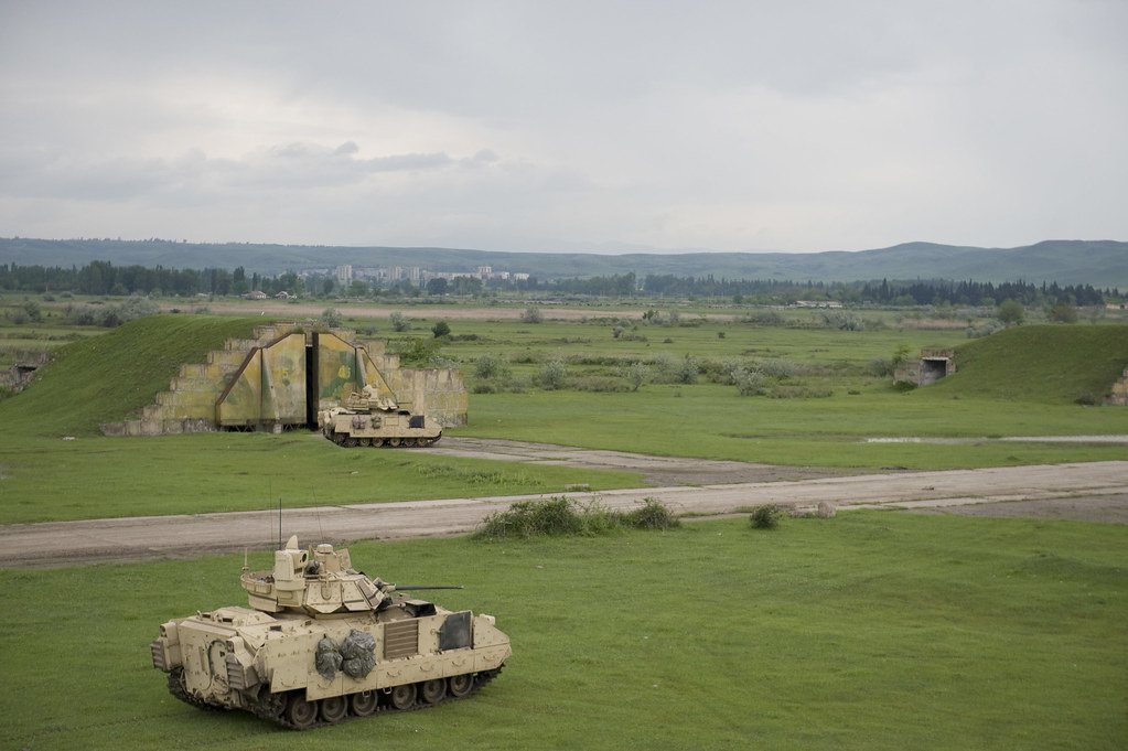
Record revision 1 · A former Soviet air-defence fighter base south-east of Tbilisi, held by Russia until 2001 and beside Georgia's main army base.
A real-world airfield as described in public sources, and how sim maps represent it. Units, facilities and names change; each is dated where the sources allow, and the charts are not for navigation. Use current official publications for flight planning.
Location and identity
- Location
- Near the village of Vaziani, south-east of Tbilisi in Kvemo Kartli, beside the Vaziani Military Base of the Georgian Defence Forces [1]
- Country or territory
- Georgia
- Coordinates
- 41.6280° N, 45.0308° E [3]
- Elevation
- 1,460 ft (445 m) [3]
- Identifiers
- UG27
- Other names
- None recorded
- Opened
- a Soviet air-defence fighter airfield by March 1946, when the 982nd Fighter Regiment moved there [2]
- Theatre
- The Caucasus
Role and operators
- Status
- Active · Military
- Roles today
- Forward staging and deployments
- Operators
- Soviet Air Defence Forces, then Soviet Air Forces · Soviet Union (until 1991), air force · 1946–1991 [2]
- Russian forces, kept the base after Georgian independence until their withdrawal under the 1999 OSCE Istanbul agreements · Russia, joint or defence-wide · 1991 – Jun 2001 [1]
- Defence Forces of Georgia, the airfield adjoins the army's Vaziani Military Base · Georgia, joint or defence-wide · since 2001 [1]
Units
Permanently based units belong to the airfield; rotational and temporarily deployed units are there for a period or an operation. Dates are when the sources place each unit there; "as of" is when a source described it as current.
Earlier
982nd Fighter Aviation Regiment, which moved to Vaziani in March 1946 and was withdrawn to Tambov in Russia and disbanded in December 1992 [2]
- Service
- Soviet Union (until 1991), air force
- Basing
- Not stated in the sources
- Aircraft
- Yak-9, MiG-15, MiG-17, MiG-21, MiG-23MLA, MiG-23MLD
- When
- Mar 1946 – Dec 1992
Runways and facilities
The sources do not date these figures. Facilities not listed here are not documented in the sources cited, which does not mean the airfield lacks them.
| Runway | Length | Width | Surface |
|---|---|---|---|
| 14/32 [3] | 8,205 ft (2,501 m) | 175 ft (53 m) | concrete |
- Arresting gear
- None documented in the sources cited
- Navaids
- None documented in the sources cited
Figure 1 — Airfield map of Vaziani Air Base (to scale)
- Runway
- Taxiway
- Airfield boundary
Runways, taxiways, aprons and buildings inside the airfield boundary, true north up, drawn from OpenStreetMap data retrieved 2026-10-28. Widths come from the map data or, where it gives none, a typical 45 m runway and 18 m taxiway. Map data © OpenStreetMap contributors, available under the ODbL 1.0. Community-mapped, not an official aerodrome chart, and not for navigation.
Sim maps
Represented in: DCS: Caucasus
DCS: Caucasus DCS World · Present day
Represented as “Vaziani” · checked 2026-10-28 [4]
- Runway 13R/31L [4]
- Tower 140.0 MHz VHF and 269.0 MHz UHF [4]
- TACAN 22X (VAS), with an ILS at each end of the runway on 108.75 MHz (IVZ on 13R, IVI on 31L) [4]
Differences from the real airfield
Only the maps marked represented or confirmed absent have been checked. Any other map may or may not represent this airfield.
Role today
Vaziani Air Base is a former Soviet airfield south-east of Tbilisi, still in limited use beside the Vaziani Military Base, the Georgian Land Forces’ Eastern Command hub and home of the 4th Mechanized Brigade. [1] The base hosted multinational exercises with US and NATO forces, Agile Spirit and Noble Partner among them, until Georgia suspended those ties in 2024. [1]
History
The 982nd Fighter Regiment of the Soviet Air Defence Forces moved to Vaziani in March 1946 with Yak-9s; over the next decades it flew MiG-15s, MiG-17s from 1954, MiG-21s from 1962 and MiG-23MLAs and MLDs from 1978, and in 1985 and 1986 it sent squadrons of MiG-23s to Kandahar in Afghanistan. [2] After the Soviet Union broke up, the regiment was withdrawn to Tambov in Russia in December 1992 and disbanded there. [2]
Russia kept the Vaziani base after Georgia became independent, as one of its four main installations in the country in the 1990s. [1] Under the 1999 OSCE Istanbul agreements it undertook to leave, and the withdrawal was completed in late June 2001; in January 2002 Georgian officials reported four radiation sources left behind. [1] On 9 August 2008, during the Russo-Georgian War, the Russian Air Force bombed the base; no casualties were reported and it stayed operational. [1]
The airfield
A single concrete runway, about 2,500 m long. [3] The army base describes it as a Soviet-era airstrip occasionally used for support operations. [1]
Sources
- Vaziani Military Base. Wikipedia (secondary source). https://en.wikipedia.org/wiki/Vaziani_Military_Base (accessed 2026-10-28). Covers the army base and, in passing, the adjoining air base. Some of its Soviet-era claims are hedged in the article and are not repeated here.
- 982-й истребительный авиационный полк ПВО (982nd Fighter Aviation Regiment). Russian Wikipedia (secondary source, in Russian). https://ru.wikipedia.org/wiki/982-й_истребительный_авиационный_полк_ПВО (accessed 2026-10-28). Post-war history: the move to Vaziani in March 1946, re-equipment, and withdrawal in December 1992.
- Airport and runway data, UG27. OurAirports open data (public domain, community-maintained). https://davidmegginson.github.io/ourairports-data/airports.csv (accessed 2026-10-28). Rows for UG27 Vaziani Air Base in airports.csv and runways.csv.
- dcs-world-schema reference data: Caucasus airbases (Vaziani.json). dcs-world-schema, open-source data extracted by running DCS World 2.9.30.28536. https://github.com/YoloWingPixie/dcs-world-schema/blob/c3091e6c08fb8167e26145d0e33c10e4140c6fe7/dcs-world-reference/latest/airbases/Caucasus/Vaziani.json (accessed 2026-10-28). With its beacon and navaid files, as tabled on the DCS: Caucasus map page.
Wikipedia articles are secondary sources and can change; they are cited with the date they were read. FAA airport data and diagrams are official but are reissued every 28 or 56 days; each is cited with the edition read. pydcs mirrors the DCS terrain data at the commit linked.