
Drafted — not technically validated
Record revision 1 · Qatar's main air base and the largest US military base in the Middle East, with Central Command's forward headquarters and air operations centre.
A real-world airfield as described in public sources, and how sim maps represent it. Units, facilities and names change; each is dated where the sources allow, and the charts are not for navigation. Use current official publications for flight planning.
Location and identity
- Location
- Southwest of Doha, Qatar [1]
- Country or territory
- Qatar
- Coordinates
- 25.1173° N, 51.3150° E [3]
- Elevation
- 131 ft (40 m) [1]
- Identifiers
- ICAO OTBH · IATA XJD
- Other names
- None recorded
- Opened
- Built by Qatar in 1996; first used by the US Air Force in September 2001 [1]
- Theatre
- Middle East
Role and operators
- Status
- Active · Military
- Roles today
- Command headquarters · Forward staging and deployments · Airlift and tanker · Fighter and strike
Units
Permanently based units belong to the airfield; rotational and temporarily deployed units are there for a period or an operation. Dates are when the sources place each unit there; "as of" is when a source described it as current.
Current
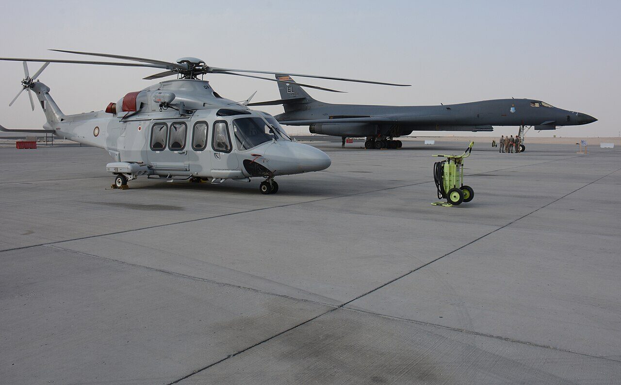
Qatar Emiri Air Force headquarters, squadrons and air college [1]
- Service
- Qatar, air force
- Basing
- Permanently based
- Aircraft
- F-15QA, C-17, C-130J, AH-64E, AW139
- When
- as of Oct 2026
379th Air Expeditionary Wing and the headquarters of US Air Forces Central [1]
- Service
- United States, air force
- Basing
- Not stated in the sources
- When
- as of Oct 2026
Forward headquarters of US Central Command, and the Combined Air Operations Center for the Middle East [1]
- Service
- United States, joint or defence-wide
- Basing
- Not stated in the sources
- When
- since Apr 2003
No. 83 Expeditionary Air Group, Royal Air Force; headquarters for Operation Shader [1]
- Service
- United Kingdom, air force
- Basing
- Not stated in the sources
- When
- since 2014
Earlier
RAF Al Udeid Wing, 268 sorties over Iraq [1]
- Service
- United Kingdom, air force
- Basing
- Temporarily deployed
- Aircraft
- Tornado GR4
- When
- 20 Mar 2003 – 15 Apr 2003
Royal Australian Air Force Hornets: 14 aircraft, over 670 sorties [1]
- Service
- Australia, air force
- Basing
- Temporarily deployed
- Aircraft
- F/A-18 Hornet
- When
- 2003
Runways and facilities
The sources do not date these figures. Facilities not listed here are not documented in the sources cited, which does not mean the airfield lacks them.
| Runway | Length | Width | Surface |
|---|---|---|---|
| 16L/34R [1] | 12,303 ft (3,750 m) | Not given | asphalt |
| 16R/34L [1] | 12,303 ft (3,750 m) | Not given | Not given |
- Arresting gear
- None documented in the sources cited
- Navaids
- None documented in the sources cited
Sim maps
Represented in: no map checked so far
DCS: Persian Gulf DCS World · Present day
Confirmed absent · checked 2026-10-27 [2]
Only the maps marked represented or confirmed absent have been checked. Any other map may or may not represent this airfield.
Other maps in Middle East, not yet checked for this airfield, which may lie outside them: DCS: Syria, DCS: Sinai, DCS: Iraq, DCS: Iraq North, Falcon BMS: Israel.
Role today
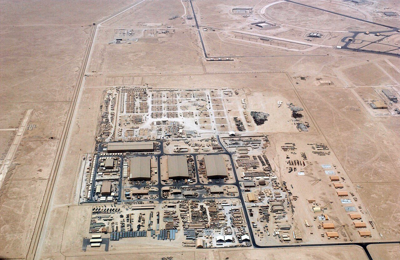
Al Udeid, southwest of Doha, is the largest US military base in the Middle East, with about 10,000 military personnel in 2026. [1] It is a Qatari base: it is the main headquarters of the Qatar Emiri Air Force, and it also hosts the US Air Force, the Royal Air Force and other foreign forces. [1] The forward headquarters of US Central Command, the headquarters of US Air Forces Central and the 379th Air Expeditionary Wing are there, and with Qatar’s other facilities it is a hub for command, logistics and basing across Central Command’s area, overseeing US air operations over Iraq, Afghanistan and Syria. [1]
History
Qatar built the base in 1996 at a cost of more than $1 billion, when its own air force was small, after a defence cooperation agreement with the United States that followed the 1991 Gulf War. [1] The US Air Force first used it, then in secret, in late September 2001, to position aircraft for operations over Afghanistan; the base was acknowledged in March 2002. [1] In April 2003, early in the Iraq War, the US Combat Air Operations Center for the Middle East moved there from Prince Sultan Air Base in Saudi Arabia. [1]
In the 2003 invasion of Iraq the RAF’s Al Udeid Wing, with Tornado GR4s, flew 268 sorties between 20 March and 15 April, and 14 Australian F/A-18 Hornets flew over 670 sorties, 350 of them in combat over Iraq. [1] Since 2014 it has been the headquarters for British air strikes against ISIS, Operation Shader. [1] In June 2017 it hosted more than 11,000 US and coalition personnel and over 100 operational aircraft. [1] On 23 June 2025 Iran fired missiles at the base in retaliation for US strikes on its nuclear sites; Qatar reported no casualties. [1]

Sources
- Al Udeid Air Base. Wikipedia (secondary source). https://en.wikipedia.org/wiki/Al_Udeid_Air_Base (accessed 2026-10-27).
- pydcs terrain data: Persian Gulf airports (airports.py). pydcs, an open-source Python library for building DCS World missions, whose terrain data mirrors the game's. https://github.com/pydcs/dcs/blob/5ddcc63a2dcd661e16b14f7aa43219b93044855d/dcs/terrain/persiangulf/airports.py (accessed 2026-10-27). The Persian Gulf map lists 29 airfields in Iran, the UAE and Oman; Al Udeid is not among them.
- Airport data, OTBH. OurAirports open data (public domain, community-maintained). https://davidmegginson.github.io/ourairports-data/airports.csv (accessed 2026-10-28). Row for OTBH: latitude, longitude and identifiers.
Wikipedia articles are secondary sources and can change; they are cited with the date they were read. FAA airport data and diagrams are official but are reissued every 28 or 56 days; each is cited with the edition read. pydcs mirrors the DCS terrain data at the commit linked.