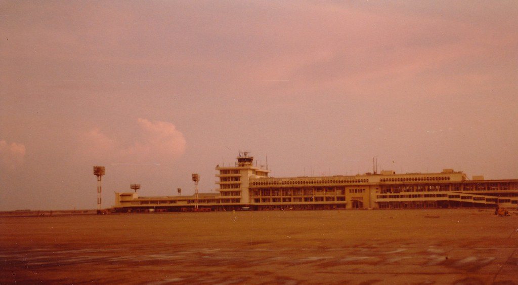
Drafted — not technically validated
Record revision 1 · Lebanon's only working commercial airport: the 1968 Israeli raid, the 1983 barracks bombing and the 2006 runway strikes.
A real-world airfield as described in public sources, and how sim maps represent it. Units, facilities and names change; each is dated where the sources allow, and the charts are not for navigation. Use current official publications for flight planning.
Location and identity
- Location
- In the southern suburbs of Beirut, Lebanon [1]
- Country or territory
- Lebanon
- Coordinates
- 33.8198° N, 35.4874° E [2]
- Elevation
- 87 ft (27 m) [2]
- Identifiers
- ICAO OLBA · IATA BEY
- Other names
- Beirut International Airport (former name, until 2005) [1]
- Opened
- on 23 April 1954, replacing the much smaller Bir Hassan Airfield a short distance north [1]
- Theatre
- Middle East
Role and operators
- Status
- Active · Civil
- Roles today
- Civil airport
- Operators
- Directorate General of Civil Aviation, part of the Ministry of Public Works and Transport; also runs air traffic control for Lebanon · Lebanon, civil · as of Oct 2026 [1]
Runways and facilities
The sources do not date these figures. Facilities not listed here are not documented in the sources cited, which does not mean the airfield lacks them.
| Runway | Length | Width | Surface |
|---|---|---|---|
| 03/21 [1] [2]the main take-off runway, the longest | 12,467 ft (3,800 m) | 148 ft (45 m) | concrete |
| 16/34 [1] [2]the landing runway built out into the sea; designated 17/35 until 2004 | 11,138 ft (3,395 m) | 148 ft (45 m) | concrete |
| 17/35 [1] [2]an original runway, designated 18/36 until 2004; still open but rarely used | 10,663 ft (3,250 m) | 197 ft (60 m) | asphalt |
- Arresting gear
- None documented in the sources cited
- Navaids
- None documented in the sources cited
Figure 1 — Airfield map of Beirut–Rafic Hariri International Airport (to scale)
- Runway
- Taxiway, with its name
- Apron
- Airfield boundary
Runways, taxiways, aprons and buildings inside the airfield boundary, true north up, drawn from OpenStreetMap data retrieved 2026-10-28. Widths come from the map data or, where it gives none, a typical 45 m runway and 18 m taxiway. Map data © OpenStreetMap contributors, available under the ODbL 1.0. Community-mapped, not an official aerodrome chart, and not for navigation.
Sim maps
Represented in: DCS: Syria
DCS: Syria DCS World · Present day
Represented as “Beirut-Rafic Hariri” · checked 2026-10-28 [3]
Only the maps marked represented or confirmed absent have been checked. Any other map may or may not represent this airfield.
Other maps in Middle East, not yet checked for this airfield, which may lie outside them: DCS: Persian Gulf, DCS: Sinai, DCS: Iraq, DCS: Iraq North, Falcon BMS: Israel.
Role today
Beirut–Rafic Hariri is the only working commercial airport in Lebanon, the hub of Middle East Airlines and, with the Port of Beirut, the country’s main port of entry; it took the name of the former prime minister Rafic Hariri after his assassination in 2005. [1] The Directorate General of Civil Aviation runs it and Lebanon’s air traffic control. [1] Its security has long been entangled with Hezbollah: in 2008 the government found a hidden camera network in the terminals and fired the security chief, Hezbollah fighters took to the streets in response, and in June 2024 The Telegraph reported that Hezbollah stored Iranian weapons at the airport. [1]
History
The airport opened on 23 April 1954 with two asphalt runways, replacing Bir Hassan Airfield. [1] On the night of 28 December 1968, in reprisal for an attack on an El Al airliner in Athens, Israeli commandos raided it and destroyed 14 Lebanese airliners. [1] The civil war from 1975 cost it almost all its airlines; Israeli shelling badly damaged the terminal in the 1982 invasion, and in 1983 the airport was the site of the Beirut barracks bombing, in which 241 American servicemen were killed. [1]
A ten-year rebuilding began in 1994, adding a new terminal and two concrete runways: 17/35, built out into the sea to keep landing traffic away from the city, and a new 03/21 alongside the old one, which became a taxiway. [1] In 2004 the runways were renamed after their headings were measured more accurately: the sea runway became 16/34 and the old 18/36 became 17/35. [1] On 13 July 2006, at the start of the 2006 Lebanon War, Israeli missiles struck all three runways, saying Hezbollah received weapons through the airport; it reopened on 17 August, and Israel’s air blockade ended on 7 September. [1]
The airfield
Three runways: 03/21 for take-offs, the longest at 12,467 ft; 16/34 for landings, built out into the sea; and the old 17/35, still open but rarely used. [1] [2]
Sources
- Beirut–Rafic Hariri International Airport. Wikipedia (secondary source). https://en.wikipedia.org/wiki/Beirut–Rafic_Hariri_International_Airport (accessed 2026-10-28). History from 1954, the wars, the rebuilding and the runways.
- Airport and runway data, OLBA. OurAirports open data (public domain, community-maintained). https://davidmegginson.github.io/ourairports-data/airports.csv (accessed 2026-10-28). Rows for OLBA in airports.csv and runways.csv: position, elevation and the three runways.
- dcs-world-schema reference data: Syria airbases (Beirut-Rafic Hariri.json). dcs-world-schema, open-source data extracted by running DCS World 2.9.30.28536. https://github.com/YoloWingPixie/dcs-world-schema/blob/c3091e6c08fb8167e26145d0e33c10e4140c6fe7/dcs-world-reference/latest/airbases/Syria/Beirut-Rafic%20Hariri.json (accessed 2026-10-28). With its beacon and navaid files, as tabled on the DCS: Syria map page.
Wikipedia articles are secondary sources and can change; they are cited with the date they were read. FAA airport data and diagrams are official but are reissued every 28 or 56 days; each is cited with the edition read. pydcs mirrors the DCS terrain data at the commit linked.