
Drafted — not technically validated
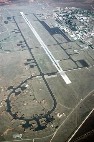
Record revision 1 · A Turkish air base near Adana shared with the US Air Force: Cold War U-2 base, Gulf War northern front and home of the 39th Air Base Wing.
A real-world airfield as described in public sources, and how sim maps represent it. Units, facilities and names change; each is dated where the sources allow, and the charts are not for navigation. Use current official publications for flight planning.
Location and identity
- Location
- Adana, Turkey, about 32 km inland from the Mediterranean [1]
- Country or territory
- Turkey
- Coordinates
- 37.0021° N, 35.4259° E [5]
- Elevation
- 232 ft (71 m) [1]
- Identifiers
- ICAO LTAG · IATA UAB
- Other names
- Adana Air Base (former name, 21 Feb 1955 – 28 Feb 1958) [1]
- Opened
- Built by the US Army Corps of Engineers from 1951; opened as Adana Air Base on 21 February 1955 and renamed Incirlik on 28 February 1958 [1]
- Theatre
- Middle East
Role and operators
- Status
- Active · Military
- Roles today
- Forward staging and deployments
Units
Permanently based units belong to the airfield; rotational and temporarily deployed units are there for a period or an operation. Dates are when the sources place each unit there; "as of" is when a source described it as current.
Current
10th Main Jet Base Command [1]
- Service
- Turkey, air force
- Basing
- Permanently based
- When
- as of Oct 2026
39th Air Base Wing [1]
- Service
- United States, air force
- Basing
- Permanently based
- When
- as of Oct 2026
73rd Anti-aircraft Artillery Regiment (Patriot) [1]
- Service
- Spain, army
- Basing
- Not stated in the sources
- When
- as of Oct 2026
US squadrons on temporary training tours through the 1970s and 1980s [1]
- Service
- United States, air force
- Basing
- Rotational
- Aircraft
- F-4, F-15, F-16, F-111, A-10, C-130
- When
- date not given
Earlier
Joint Task Force Proven Force: about 140 aircraft opening a northern front against Iraq [1]
- Service
- United States, joint or defence-wide
- Basing
- Temporarily deployed
- When
- 1991
Tactical Air Command composite strike force for the Lebanon crisis [1]
- Service
- United States, air force
- Basing
- Temporarily deployed
- Aircraft
- F-100, B-57, RF-101, B-66
- When
- 1958
Runways and facilities
The sources do not date these figures. Facilities not listed here are not documented in the sources cited, which does not mean the airfield lacks them.
- Arresting gear
- None documented in the sources cited
- Navaids
- None documented in the sources cited
- Other
- About 57 hardened aircraft shelters [1]
Figure 1 — Airfield map of Incirlik Air Base (to scale)
- Runway
- Taxiway, with its name
- Apron
- Hangar or terminal
- Airfield boundary
Runways, taxiways, aprons and buildings inside the airfield boundary, true north up, drawn from OpenStreetMap data retrieved 2026-10-28. Widths come from the map data or, where it gives none, a typical 45 m runway and 18 m taxiway. Map data © OpenStreetMap contributors, available under the ODbL 1.0. Community-mapped, not an official aerodrome chart, and not for navigation.
Sim maps
Represented in: DCS: Syria
DCS: Syria DCS World · Present day
Only the maps marked represented or confirmed absent have been checked. Any other map may or may not represent this airfield.
Other maps in Middle East, not yet checked for this airfield, which may lie outside them: DCS: Persian Gulf, DCS: Sinai, DCS: Iraq, DCS: Iraq North, Falcon BMS: Israel.
Role today
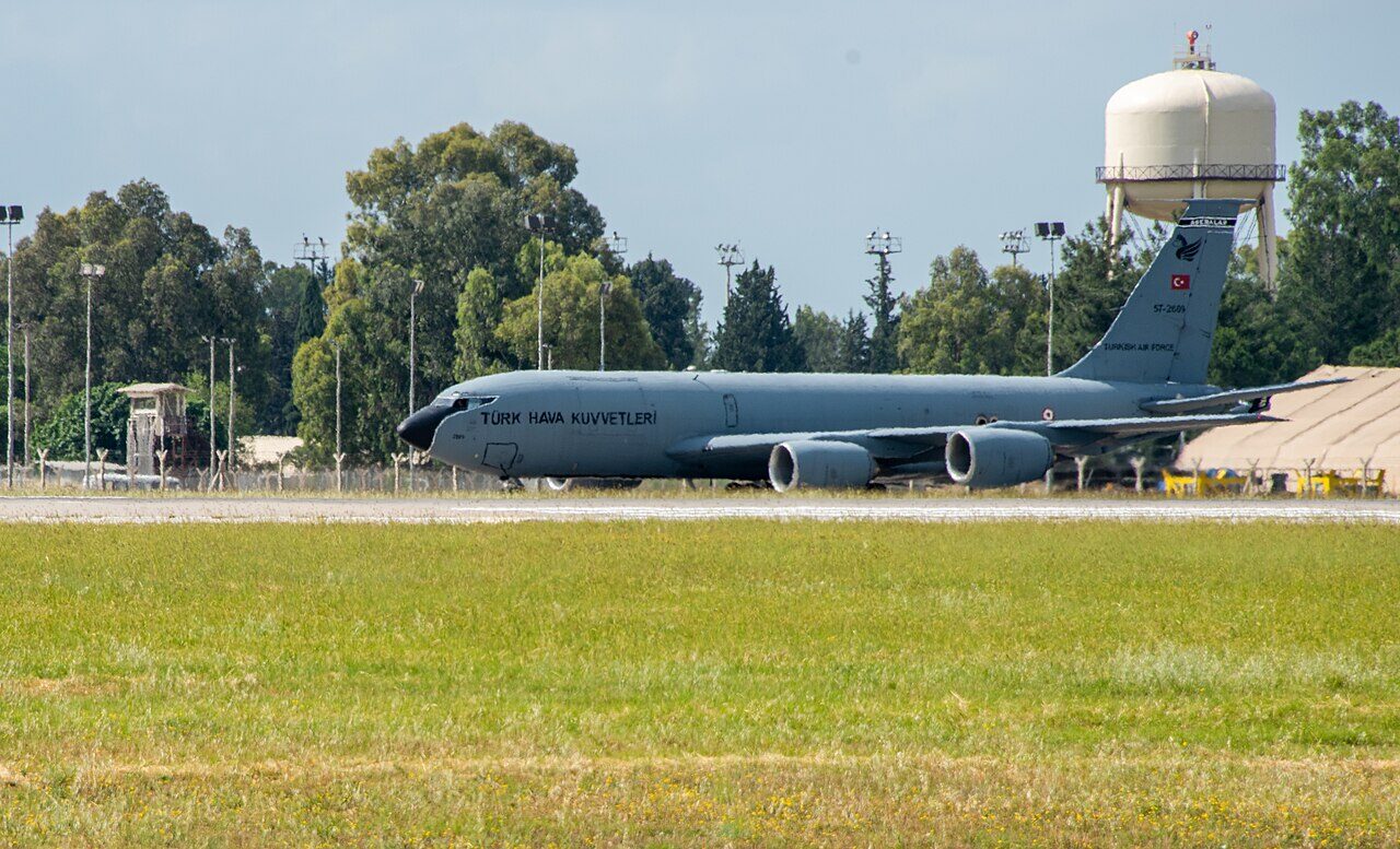
Incirlik is a Turkish Air Force base on the edge of Adana, in southern Turkey, about 32 km inland from the Mediterranean, used jointly by the Turkish and US air forces. [1] The Turkish Air Force owns the base and all its facilities and keeps its 10th Main Jet Base there; the US Air Force’s 39th Air Base Wing is the main American unit, and the Royal Air Force and Royal Saudi Air Force have also flown from it. [1] A Spanish Army Patriot regiment is based there too. [1]
History
The decision to build the base dates from the Second Cairo Conference of December 1943, but work began only in 1951, as an emergency staging and recovery field for US medium and heavy bombers. [1] In the early Cold War it was a reconnaissanceReconnaissance GlossaryJoint terms: A mission undertaken to obtain, by visual observation or other detection methods, information about the activities and resources of an enemy or adversary, or to secure data concerning the meteorological, hydrographic, or… base: GENETRIX balloons were launched from it from 1956, and it was the main U-2 base in the region until Francis Gary Powers was shot down over the Soviet Union by SA-2SA-2 Guideline Threat systemThe classic six-launcher site around a Fan Song radar: radio-command-guided, and the SAM US crews met over North Vietnam. missiles on 1 May 1960. [1] In the 1958 Lebanon crisis, a Tactical Air Command composite strikeStrike GlossaryJoint terms: An attack to damage or destroy an objective or a capability. force of F-100sF-100 Super Sabre AircraftThe first US Air Force fighter supersonic in level flight; a fighter-bomber and fast FAC in Vietnam., B-57s, RF-101s and B-66s flew straight to Incirlik from the United States. [1]
US fighter squadrons rotated through Incirlik for training through the 1970s and 1980s, using a Turkish air-to-ground range near Konya and an air-to-air range over the Mediterranean; F-4sF-4 Phantom II AircraftThe big two-seat Cold War fighter-bomber; the F-4E added an internal gun and slats after Vietnam., F-15sF-15C Eagle AircraftA twin-engine air superiority fighter with more than 104 air-to-air victories and no losses., F-16sF-16 Fighting Falcon AircraftA single-engine multirole fighter: fly-by-wire, 9 g, and the US Air Force's main strike and SEAD aircraft., F-111s, A-10sA-10 Thunderbolt II AircraftThe Warthog: a straight-wing, armoured close air support jet built around the 30 mm GAU-8 cannon. and C-130s all served temporary tours there. [1] In the 1991 Gulf War, Incirlik was the base for Joint Task Force Proven Force, about 140 aircraft that opened a northern front against Iraq, and afterwards it supported the northern no-fly zone, Operation Northern Watch. [1]

Sources
- Incirlik Air Base. Wikipedia (secondary source). https://en.wikipedia.org/wiki/Incirlik_Air_Base (accessed 2026-10-27).
- Runway data, LTAG Incirlik Air Base. OurAirports open data (public domain, community-maintained). https://davidmegginson.github.io/ourairports-data/runways.csv (accessed 2026-10-27). Row for LTAG: threshold latitude and longitude, length and width.
- DCS: Syria Map. Eagle Dynamics and Ugra Media (product page). https://www.digitalcombatsimulator.com/en/shop/terrains/syria_terrain/ (accessed 2026-10-27).
- pydcs terrain data: Syria airports (airports.py). pydcs, an open-source Python library for building DCS World missions, whose terrain data mirrors the game's. https://github.com/pydcs/dcs/blob/5ddcc63a2dcd661e16b14f7aa43219b93044855d/dcs/terrain/syria/airports.py (accessed 2026-10-27). Incirlik entry: ATC radios, runway and runway beacons.
- Airport data, LTAG. OurAirports open data (public domain, community-maintained). https://davidmegginson.github.io/ourairports-data/airports.csv (accessed 2026-10-28). Row for LTAG: latitude, longitude and identifiers.
Wikipedia articles are secondary sources and can change; they are cited with the date they were read. FAA airport data and diagrams are official but are reissued every 28 or 56 days; each is cited with the edition read. pydcs mirrors the DCS terrain data at the commit linked.