Drafted — not technically validated
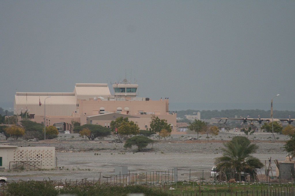
Record revision 1 · Oman's public and military airport in a mountain valley at Khasab, capital of Musandam on the Strait of Hormuz.
A real-world airfield as described in public sources, and how sim maps represent it. Units, facilities and names change; each is dated where the sources allow, and the charts are not for navigation. Use current official publications for flight planning.
Location and identity
- Location
- Serving Khasab, capital of Oman's Musandam Governorate, on the Strait of Hormuz [1]
- Country or territory
- Oman
- Coordinates
- 26.1708° N, 56.2406° E [1]
- Identifiers
- ICAO OOKB · IATA KHS
- Other names
- None recorded
- Opened
- no opening date is given in the sources consulted
- Theatre
- Middle East
Role and operators
- Status
- Active · Civil
- Roles today
- Civil airport
- Operators
- Oman Air, the infobox lists the airport as public and military · Oman, civil · as of Oct 2026 [1]
Runways and facilities
The sources do not date these figures. Facilities not listed here are not documented in the sources cited, which does not mean the airfield lacks them.
| Runway | Length | Width | Surface |
|---|---|---|---|
| 01/19 [1] [2]2,500 m; runway 19 has a displaced threshold | 8,202 ft (2,500 m) | 75 ft (23 m) | asphalt |
- Arresting gear
- None documented in the sources cited
- Navaids
- None documented in the sources cited
Figure 1 — Airfield map of Khasab Airport (to scale)
- Runway
- Taxiway
- Apron
- Hangar or terminal
- Helipad
- Airfield boundary
Runways, taxiways, aprons and buildings inside the airfield boundary, true north up, drawn from OpenStreetMap data retrieved 2026-10-28. Widths come from the map data or, where it gives none, a typical 45 m runway and 18 m taxiway. Map data © OpenStreetMap contributors, available under the ODbL 1.0. Community-mapped, not an official aerodrome chart, and not for navigation.
Sim maps
Represented in: DCS: Persian Gulf
DCS: Persian Gulf DCS World · Present day
Represented as “Khasab” · checked 2026-10-28 [3]
Only the maps marked represented or confirmed absent have been checked. Any other map may or may not represent this airfield.
Other maps in Middle East, not yet checked for this airfield, which may lie outside them: DCS: Syria, DCS: Sinai, DCS: Iraq, DCS: Iraq North, Falcon BMS: Israel.
Role today
Khasab Airport serves Khasab, the harbour town and capital of Oman’s Musandam Governorate, whose harbour opens onto the Strait of Hormuz. [1] It is listed as both a public and a military airport. [1]
History
Published sources on the airport are thin. The one recorded accident is an Oman Aviation Twin Otter that veered off the runway after its nose gear failed on landing on 5 December 1991. [1]
The airfield
The airport lies in a valley between two close mountain ridges, and another ridge stands just off the departure end of runway 19, which has a displaced threshold. [1] Its one asphalt runway, 01/19, is 2,500 m long. [1]
Sources
- Khasab Airport. Wikipedia (secondary source). https://en.wikipedia.org/wiki/Khasab_Airport (accessed 2026-10-28). A short article: the setting between mountain ridges and the runway.
- Airport and runway data, OOKB. OurAirports open data (public domain, community-maintained). https://davidmegginson.github.io/ourairports-data/airports.csv (accessed 2026-10-28). Rows for OOKB in airports.csv and runways.csv: elevation and runway 01/19.
- dcs-world-schema reference data: Persian Gulf airbases (Khasab.json). dcs-world-schema, open-source data extracted by running DCS World 2.9.30.28536. https://github.com/YoloWingPixie/dcs-world-schema/blob/c3091e6c08fb8167e26145d0e33c10e4140c6fe7/dcs-world-reference/latest/airbases/PersianGulf/Khasab.json (accessed 2026-10-28). With its beacon and navaid files, as tabled on the DCS: Persian Gulf map page.
Wikipedia articles are secondary sources and can change; they are cited with the date they were read. FAA airport data and diagrams are official but are reissued every 28 or 56 days; each is cited with the edition read. pydcs mirrors the DCS terrain data at the commit linked.